
Rupin Pass Trek is a high-altitude crossover trek that reaches approximately 15,300 ft and ends near Sangla in Himachal Pradesh. Known for waterfalls, river views, meadows and a steep pass-crossing day, it is best suited to fit trekkers prepared for changing terrain and weather.
Where Is Rupin Pass Situated?
Rupin Pass is a high-altitude mountain pass in the Himachal Himalayas, close to the border between Himachal Pradesh and Uttarakhand. The trek is best understood as a crossover journey: instead of returning along the same trail, trekkers move through the Rupin Valley, cross the pass, and descend towards the Sangla Valley in Himachal Pradesh.
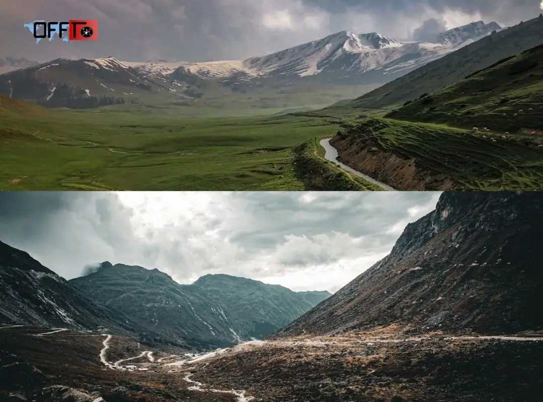
This geography is central to the appeal of the Rupin Pass trek. The approach follows the changing character of the Rupin River through villages, forests, meadows, waterfall terrain, and higher snowfields. After the pass crossing, the landscape shifts again as the trail descends towards Ronti Gad and continues in the direction of Sangla. Current itineraries commonly end on the Sangla side, making the journey feel like a progression through distinct Himalayan zones rather than a simple climb to a viewpoint and back.
How the Rupin Valley Connects With the Sangla Valley
The Rupin Valley forms the approach side of the trek. As altitude increases, the trail moves closer to the upper reaches of the river and the waterfall sections before reaching Rupin Pass. On the other side of the pass, the descent leads towards Ronti Gad and Sangla Kanda before reaching the wider Sangla Valley.
This transition is one reason the trek attracts experienced hikers. The scenery does not remain static. Rupin River views, village paths, dense fir forests, open meadows, and high-altitude terrain appear at different stages of the route.
Why Older Route Descriptions Mention Uttarakhand
Older travel guides often describe the trek as beginning at Dhaula in Uttarakhand and ending at Sangla in Himachal Pradesh. That remains useful historical context, but it does not apply to every current trek package.
Improved road access has allowed some operators to begin farther along the route. Indiahikes, for example, shifted its base camp from Dhaula in Uttarakhand to Jiskun in Himachal Pradesh after road access extended towards lower Jiskun. Its revised itinerary is two days shorter while retaining the major trail experiences, including the villages, Rupin River sections, snow bridges, waterfall terrain, and pass crossing.
Rupin Pass Trek Route: Understand the Crossover Before Booking
There is no single Rupin Pass trek route used by every operator. The core crossover experience remains similar, but the starting village, total walking distance, day-wise itinerary, and transport plan can vary. Before booking, compare the actual route rather than relying only on the number of days mentioned in a package.
A common current itinerary begins at Jiskun or Bawta in Himachal Pradesh and moves towards Jakha or Jhaka village, Saruwas Thatch, Dhanderas Thatch, Upper Waterfall Camp, Rupin Pass, Ronti Gad, and Sangla. Indiahikes currently begins at Jiskun, while Trek The Himalayas lists Bawta as its base camp.
The Broad Journey From the Base to Sangla
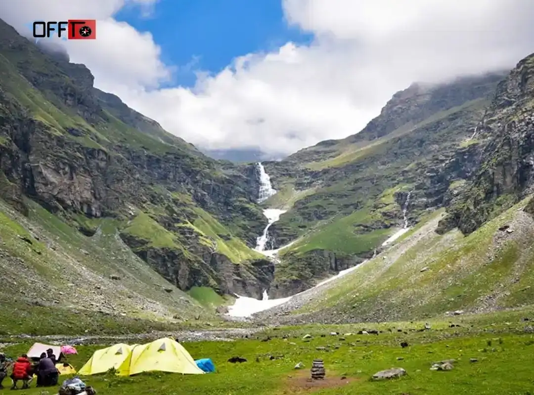
The first part of the route introduces village trails and gradual altitude gain. From Jakha — also commonly written as Jhaka — the path enters a striking fir forest before descending towards the river-side terrain. The trail then opens into Saruwas Thatch and Dhanderas Thatch, where the multi-stage Rupin Waterfall becomes one of the defining visual landmarks of the trek.
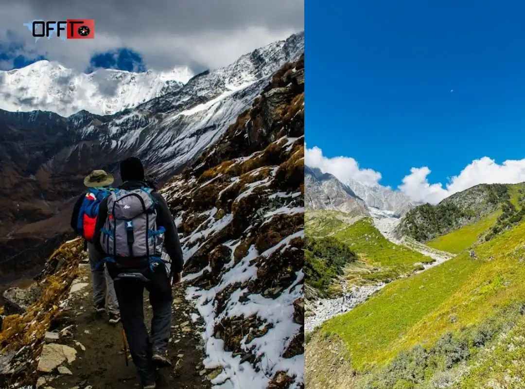
From Dhanderas Thatch, the route climbs towards Upper Waterfall Camp. The character of this section depends heavily on the season: summer routes may involve snow bridges, while autumn conditions can expose rocky and slippery terrain. The most demanding stage follows on pass-crossing day, when trekkers leave Upper Waterfall Camp, climb towards Rupin Pass, and descend to Ronti Gad. Current Indiahikes and Trek The Himalayas itineraries both describe this as a long 10–11 hour day.
The final descent continues towards Sangla, completing the crossover.
Why Starting Points Differ Across Operators
The variation is largely shaped by road access and itinerary design.
Route Pattern | Common Starting Point | What Travelers Should Know |
Current shortened itinerary | Jiskun | Cuts out parts of the older approach while retaining the major highlights |
Alternative current itinerary | Bawta | Begins in Himachal Pradesh and joins the route towards Jakha |
Legacy route | Dhaula | Longer approach from Uttarakhand, commonly found in older travel guides |
Why Some Rupin Pass Itineraries Are Shorter Than Others
A shorter itinerary does not automatically mean that the operator has removed the pass crossing or the most memorable landscapes. In many cases, road-access changes have reduced the lower approach walk.
Published Rupin Pass trek distance figures also vary. Indiahikes currently lists approximately 37 km, while Trek The Himalayas displays 42 km on its overview page and approximately 41 km in its FAQ section. These differences can reflect the chosen base camp, campsite arrangement, trail variation, and the way an operator calculates the route.
What to Compare Before Selecting an Itinerary
Before choosing a package, check:
- The starting village and pickup city
- The ending point and return transport plan
- The number of trekking days versus road-travel days
- The total walking distance
- Whether an acclimatization or rest day is included
- The campsite sequence before the pass crossing
- The expected duration of the Upper Waterfall–Rupin Pass–Ronti Gad stage
The best itinerary is not necessarily the longest or shortest option. It is the one that clearly explains the route, builds altitude sensibly, and gives trekkers realistic expectations before the demanding crossover day.
Rupin Pass Trek Distance and Duration
The Rupin Pass trek distance usually falls between 37 km and 42 km across common current itineraries. Most packages are structured as seven-day journeys, including the arrival day and the final descent towards Sangla. The exact walking distance depends on the starting village, campsite sequence, trail variation, and the way each operator calculates the route.
For example, Indiahikes currently lists a seven-day Jiskun-based itinerary covering approximately 37 km, while Trek The Himalayas lists a seven-day Bawta-based route covering approximately 42 km. These figures are not contradictory; they represent different versions of the same crossover trek.
Trekking Days Versus Arrival and Departure Days
A seven-day package does not necessarily mean seven full trekking days. The first day is usually reserved for the mountain drive, arrival, and briefing. The final day combines the descent towards Sangla with onward road travel.
The core trail is generally covered over five to six trekking days. This distinction matters when comparing packages. A shorter itinerary may simply use improved road access to reduce the lower approach, while another may include an additional trail segment or a more relaxed campsite plan.
How the Daily Distance Is Distributed
The Rupin Pass trek distance is not divided evenly. Some days are intentionally short to support acclimatization before the higher camps.
A current Jiskun-based itinerary provides a useful example:
Trail Section | Approximate Distance | Typical Duration |
Jiskun to Jakha | 5 km | 4 hours |
Jakha to Saruwas Thatch | 8.1 km | 5–6 hours |
Saruwas Thatch to Dhanderas Thatch | 3.5 km | Around 2 hours |
Dhanderas Thatch to Upper Waterfall Camp | 3 km | 2–3 hours |
Upper Waterfall Camp to Ronti Gad via Rupin Pass | 10 km | 10–11 hours |
Ronti Gad to Sangla Kanda | 5 km | Around 5 hours |
These figures should be treated as a route example rather than a universal itinerary. Trek The Himalayas, for instance, lists a 12 km pass-crossing stage and an 11 km final descent on its Bawta-based route.
Why Pass-Crossing Day Matters More Than the Total Distance
The total kilometre count does not fully explain the difficulty of the Rupin Pass trek. The decisive stage is the journey from Upper Waterfall Camp to Ronti Gad via Rupin Pass. It involves a pre-dawn start, a steep ascent, high-altitude terrain, the Rupin Gully climb, and a long descent after crossing the pass.
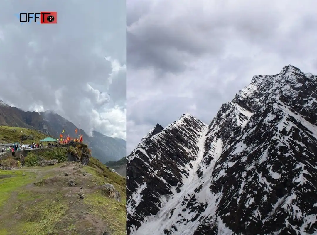
Rupin Pass Height and Altitude Profile
The maximum Rupin Pass height is approximately 15,300 ft, or around 4,650–4,700 metres. Published figures vary slightly across operator itineraries. Indiahikes lists the pass at 15,279 ft, Trek The Himalayas lists 15,350 ft, and Bikat Adventures describes the highest point at approximately 4,650 metres. For planning purposes, travelers should treat Rupin Pass as a trek that crosses the 15,000 ft mark.
How Altitude Builds Along the Route
The climb is progressive rather than abrupt. On the Jiskun-based route, trekkers begin at approximately 7,630 ft and move through Jakha at 8,755 ft, Saruwas Thatch at 10,770 ft, Dhanderas Thatch at 11,700 ft, and Upper Waterfall Camp at 13,275 ft before crossing the pass at 15,279 ft.
The shorter stages before the crossover are therefore not wasted days. The walk from Saruwas Thatch to Dhanderas Thatch is only around 3.5 km, while the next ascent to Upper Waterfall Camp is around 3 km. These stages allow the body to adjust before the most demanding climb.
Why Steady Pacing Matters
Fitness improves comfort, but it does not remove the risks associated with altitude. Indiahikes notes that the possibility of acute mountain sickness becomes relevant above 10,000 ft and that even experienced trekkers should avoid gaining height too quickly. A controlled pace, hydration, rest, and honest communication with the trek leader are more useful than trying to reach camp first.
Is the Rupin Pass Trek Difficult?
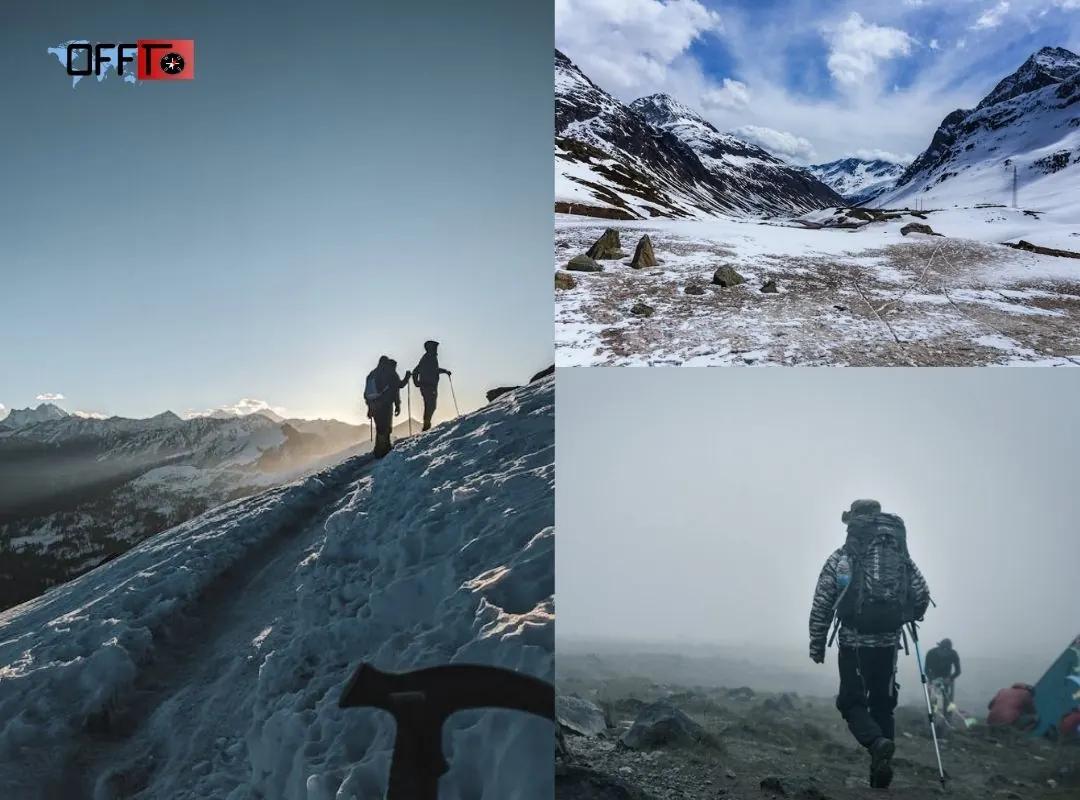
The Rupin Pass trek is generally graded as moderate to difficult. It is not an ideal choice for an unprepared first-time trekker. The route combines long walking days, altitude above 15,000 ft, snow or rocky sections, river crossings, steep ascents, boulder terrain, and a demanding pass-crossing day.
The trail becomes noticeably harder after Dhanderas Thatch. During the May–June season, trekkers may encounter snow bridges and larger snowfields. During autumn, some sections can become rocky or slippery, and river crossings may require additional care. The conditions change by season, which is why guide instructions matter more than assumptions based on photographs or older trip reports.
What Makes the Rupin Gully Climb Challenging?
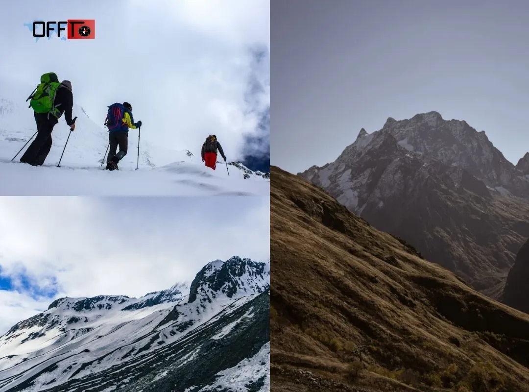
The Rupin Gully is one of the defining challenges of the trek. The pass-crossing day often begins around 3 am from Upper Waterfall Camp so that the group can approach the pass early. The climb involves steep terrain through snowfields or rocky sections, depending on the season. After reaching the top, trekkers still need enough energy for the long descent towards Ronti Gad.
This is why the route demands endurance rather than speed. A trekker who moves steadily, follows the guide’s pacing instructions, and conserves energy is often better prepared than someone who treats the ascent as a race. Weather, snow stability, fatigue, and group progress may also affect turnaround decisions.
Can Beginners Attempt the Rupin Pass Trek?
A fit beginner may consider the Rupin Pass trek after structured preparation and a realistic discussion with the selected operator. However, previous Himalayan trekking experience is preferable. Bikat Adventures describes the trek as suitable for travelers who have completed an easier route and are ready to progress to a more demanding trail. Trek The Himalayas also recommends prior trekking experience, even though it does not make that experience mandatory.
A traveler with limited fitness, no experience of consecutive walking days, or discomfort on steep terrain should begin with a gentler high-altitude trek before attempting Rupin Pass.
A Practical Fitness Readiness Checklist
Before booking the trek, assess whether you can:
- Walk or jog consistently without frequent breaks
- Manage consecutive trekking days with a backpack
- Maintain balance on uneven and rocky trails
- Handle cold starts and changing weather
- Continue steadily after several hours of ascent
- Follow guide instructions without pushing beyond safe limits
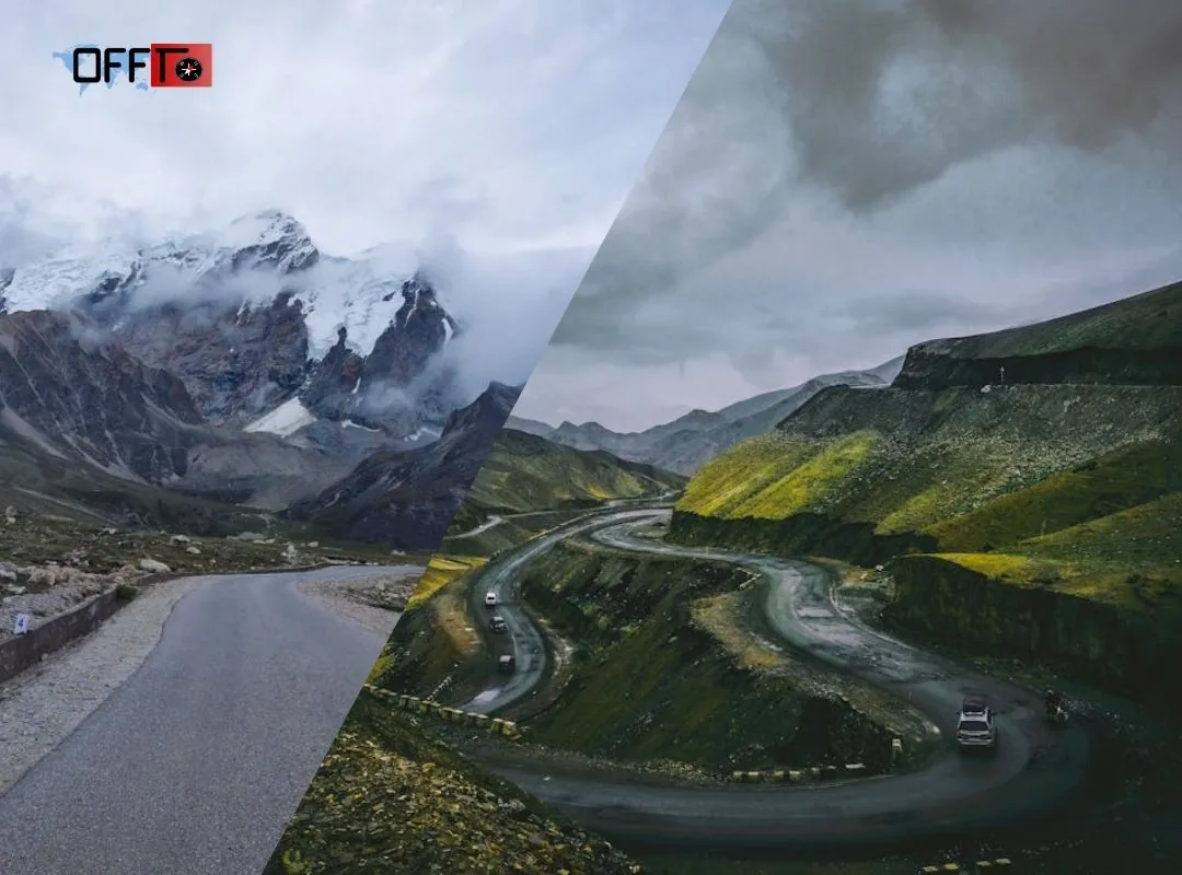
Rupin Pass Weather: What to Expect by Season
Rupin Pass weather changes noticeably with altitude and season. Lower villages can feel comfortable during the day, while exposed camps above 11,000 ft become colder after sunset. At Upper Waterfall Camp and near the pass, wind, cloud cover, and overnight temperatures can make conditions feel significantly harsher than the forecast for the base village.
The Rupin Pass trek best time generally falls within two windows: mid-May to the end of June and mid-September to mid-October. Each season offers a different experience.
Summer: Mid-May to the End of June
Summer is the preferred season for trekkers who want snow bridges, higher snowfields, and a greener Rupin Valley. Daytime temperatures are often comfortable while walking, but nights at the higher camps can fall close to 0°C. Conditions also vary by altitude: the lower trail may feel mild while Upper Waterfall Camp remains cold and exposed.
May usually offers the stronger snow experience. By June, snow begins to recede from the lower sections while remaining more common around Upper Waterfall Camp, Rata Pheri, Rupin Gully, and the higher route towards Ronti Gad.
Autumn: Mid-September to Mid-October
Autumn suits trekkers who prefer clearer trails, green-to-golden landscapes, and fewer extended snow sections. Daytime temperatures are generally cool and manageable, but nighttime temperatures at the higher camps can fall below freezing. Frost is possible near Upper Waterfall Camp, and fresh snowfall may affect the pass when weather systems change.
Why Forecasts Must Be Checked Close to Departure
Mountain weather is variable. Rain at the lower camps, wind near the pass, fresh snowfall, and changing trail conditions can affect the daily plan. Seasonal averages are useful for packing, but they should not replace a current forecast or the trek leader’s instructions.
Is There Snow in Rupin Pass in June?
Yes, trekkers commonly encounter snow on the higher sections of the Rupin Pass trek in June, but the amount and location vary through the month.
During the first half of June, the trail often combines green meadows with snow around the upper waterfall sections and the approach to the pass. As the month progresses, snow may retreat from lower elevations while remaining around Rata Pheri, Rupin Gully, and sections of the descent towards Ronti Gad.
Snow bridges and patches should be treated as trail conditions rather than sightseeing features. They can affect grip, pacing, and safety. Because snowfall and melting patterns differ from year to year, travelers should confirm current conditions with the operator shortly before departure.
Rupin Pass Trek Itinerary: A Realistic Day-by-Day Plan
A typical Rupin Pass trek itinerary takes seven days, including the arrival day and the descent towards Sangla. The route below follows a common Jiskun-based pattern. Operators may begin from Bawta or use a slightly different campsite sequence, so confirm the final itinerary before booking transport.
Day 1: Reach the Base and Rest After the Mountain Drive
The first day is reserved for reaching the selected base village, completing the briefing, and recovering after the road journey. Keep the evening unhurried. The next few days involve consistent altitude gain, so arriving rested matters more than adding extra activity.
Day 2: Trek Towards Jhaka
The first walking day introduces village trails and a steady ascent towards Jhaka, also written as Jakha. This is the right stage to settle into a comfortable pace rather than walking too quickly. Save energy for the longer stages ahead.
Day 3: Move Through Forests and River-Side Terrain
The trail continues through a fir forest before descending towards the Rupin River and opening into wider valley terrain. This is one of the longer walking days, but the changing scenery helps break up the effort. Consistent hydration and pacing become important.
Day 4: Reach Dhanderas Thatch and Slow Down
The walk towards Dhanderas Thatch is shorter, allowing time to recover while gaining altitude gradually. The campsite is known for views of the multi-stage Rupin Waterfall. This slower stage helps prepare the body for the more demanding climb towards the upper camp.
Day 5: Climb Towards Upper Waterfall Camp
The ascent becomes more continuous as the route moves towards Upper Waterfall Camp. In summer, snow bridges may shape the trail. In autumn, exposed rocky and slippery sections may require additional care. The stage is relatively short, but the altitude gain makes steady pacing essential.
Day 6: Cross Rupin Pass and Descend Towards Ronti Gad
This is the defining day of the trek. The group usually leaves before sunrise and climbs through high-altitude terrain towards Rupin Gully and the pass. After the steep ascent, the route descends towards Ronti Gad.
The day commonly takes around 10–11 hours. It is not a relaxed sightseeing stage. Trekkers need enough endurance for both the climb and the long descent, while following the guide’s instructions on pacing, snow conditions, and group movement.
Day 7: Descend Towards Sangla and Plan the Return Journey
The final trail section descends towards Sangla Kanda and the Sangla side of the valley. The trek may be ending, but the day can still feel tiring after the pass crossing. Avoid booking tight onward connections. Mountain-road delays and a late arrival in Shimla are possible, depending on the operator’s transport plan.
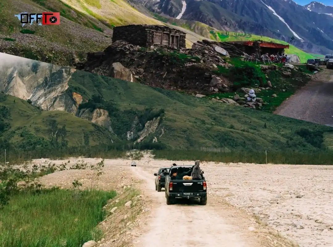
How to Reach the Rupin Pass Trek Starting Point
Shimla is the most practical gateway for reaching the Rupin Pass trek starting point on current Jiskun-based itineraries. From Shimla, trekkers usually travel towards Rohru and continue by road to the selected base village. The final mountain drive is long and winding, so the arrival day should remain free of additional plans.
Common Access via Shimla
Shimla offers the most convenient access for travelers arriving from major cities. Depending on the selected operator, the onward journey may begin from Shimla, Rohru, or another designated pickup point.
Road Journey to the Selected Base
The road route generally continues through the hills towards Rohru and the selected base village. Some current packages begin from Jiskun or nearby Bawta, while older route descriptions may still mention Dhaula in Uttarakhand.
Confirm the Pickup Point Before Booking Travel
The pickup location must be confirmed before booking bus, train, or flight tickets. One operator may coordinate the journey from Shimla, while another may ask trekkers to reach Rohru or the base independently.
Keep Buffer Time for Mountain-Road Delays
Public transport on the final stretch can be limited and unpredictable. A coordinated vehicle or pre-booked cab is usually the safer planning choice. Keep a buffer day after the trek as well. The descent ends on the Sangla side, and mountain-road delays can affect the return journey.
What to Pack for the Rupin Pass Trek
Pack for changing conditions rather than the weather at the base village. Lower sections may feel comfortable during the day, while higher camps can become cold, windy, or wet.
Trekking Layers for Changing Temperatures
Carry moisture-managing trekking layers, a fleece or warm mid-layer, an insulated jacket, thermal wear, gloves, and a woollen cap. Layering is more practical than relying on one heavy jacket because conditions change as the trail gains altitude.
Rain and Snow Protection
Carry a waterproof jacket, rain cover, and quick-dry clothing. Weather conditions can shift quickly near the higher camps. Snow patches and wet trail sections may also affect comfort and grip.
Trekking Shoes and Traction Support
Choose waterproof trekking shoes with reliable grip and ankle support. Sports shoes are not suitable for uneven trails, rocky sections, or snow conditions. Ask the operator whether traction devices, gaiters, or trekking poles will be provided.
Backpack Essentials
A practical backpack should include water bottles, sunglasses, sunscreen, a headlamp, energy snacks, personal toiletries, and a small first-aid kit. Pack efficiently and avoid carrying items that add weight without improving comfort or safety.
Medication and Operator-Provided Gear
Carry any prescribed medication after discussing health concerns with a medical professional. Confirm whether specialist equipment and technical safety gear are included in the trek package before purchasing or renting anything separately.
Who Will Enjoy the Rupin Pass Trek Most?
The Rupin Pass trek is best suited to travelers who want a varied Himalayan crossover rather than a short summit-style walk. It rewards trekkers who enjoy changing landscapes, Rupin River views, forests, waterfall terrain, meadows, snowfields, and a demanding final ascent.
Trekkers Seeking a Varied Crossover Trail
The route suits hikers who value variety. The landscape changes gradually as the trail moves through villages, river-side terrain, forests, open meadows, waterfall sections, and higher snowfields before descending towards Sangla.
Fit Travelers Comfortable With a Demanding Final Ascent
The pass-crossing day requires endurance, balance, and steady pacing. Trekkers should be prepared for a long ascent and descent rather than treating the route as a relaxed sightseeing trail.
Snow Enthusiasts Choosing the May–June Window
The May–June season suits travelers looking for snow bridges, higher snowfields, and a greener Rupin Valley. Snow conditions vary by year, so current trail updates should be checked before departure.
Scenery-Led Travelers Considering the Post-Monsoon Season
The post-monsoon window suits trekkers who prefer clearer trails, changing autumn landscapes, and fewer extended snow sections. Higher camps can still become cold after sunset.
Who May Prefer an Alternative Trek?
Rupin Pass is rewarding when the challenge is chosen deliberately. It may not suit every traveler.
First-Time Trekkers Seeking a Gentler Introduction
A shorter and less demanding Himalayan route may be more appropriate for travelers with limited trekking experience or insufficient preparation.
Travelers Uncomfortable With Steep Snow or Rocky Sections
The trail can involve snowfields, uneven terrain, slippery stretches, and steep ascents. Travelers who prefer predictable walking conditions should consider an easier option.
Travelers Looking for a Shorter Crossover Experience
Anyone seeking a more accessible route with fewer demanding stages may prefer a gentler crossover trek before attempting Rupin Pass.
FAQs
Is the Rupin Pass Trek difficult?
Yes. The Rupin Pass Trek is generally graded moderate to difficult. Its challenge comes from altitude above 15,000 ft, consecutive trekking days, changing terrain, snow or rocky sections, the steep Rupin Gully climb, and the long descent after crossing the pass. Good fitness, steady pacing, and guide support are essential.
How long is the Rupin Pass Trek?
Most current Rupin Pass Trek packages take around seven days, including the arrival day and the final descent towards Sangla. The main trail is usually completed over approximately six trekking days. Compare itineraries carefully because road travel, campsite sequence, and pickup arrangements may be counted differently by each operator overall.
Where is Rupin Pass situated?
Rupin Pass is situated in the Himachal Himalayas, close to the Himachal Pradesh–Uttarakhand border. The trail approaches through the Rupin Valley and descends towards the Sangla Valley in Himachal Pradesh. This crossover geography explains why older guides mention Uttarakhand while many current itineraries begin from villages in Himachal Pradesh today.
What is the Rupin Pass Trek distance?
The Rupin Pass Trek distance is usually around 37–42 km across common current itineraries. The exact figure depends on the starting village, campsite sequence, trail variation, and operator measurement method. A shorter route does not necessarily remove the major experiences because improved road access has reduced parts of the older approach.
What is the height of Rupin Pass?
The maximum Rupin Pass height is approximately 15,300 ft, or around 4,650–4,700 metres. Published figures vary slightly: some operators list 15,279 ft, while others mention 15,350 ft. Travelers should treat it as a high-altitude trek crossing the 15,000 ft mark and plan acclimatization carefully throughout the entire journey from start to finish.
What is the best time for the Rupin Pass Trek?
The best time for the Rupin Pass Trek is generally mid-May to the end of June and mid-September to mid-October. Choose summer for snow bridges, higher snowfields, and greener valleys. Choose the post-monsoon season for clearer trails, crisper views, and changing autumn landscapes across the route, especially after the rains.
Is there snow in Rupin Pass in June?
Yes. Snow commonly remains on the higher sections of Rupin Pass in June, particularly earlier in the month. Trekkers may encounter patches, snow bridges, and larger snowfields around the waterfall sections, Rata Pheri, Rupin Gully, and the descent. Conditions vary annually, so request a current trail update before departure.
Can beginners attempt the Rupin Pass Trek?
A fit and well-prepared beginner may attempt the Rupin Pass Trek with professional guidance, but prior Himalayan trekking experience is preferable. The route includes altitude, long walking days, steep terrain, and a demanding crossover stage. Travelers without consistent fitness or comfort on uneven trails should begin with a gentler Himalayan trek.
Is Rupin Pass a crossover trek?
Yes. Rupin Pass is a crossover trek because the route does not return along the same path. Trekkers approach through the Rupin Valley, cross the high-altitude pass, and descend towards Sangla in Himachal Pradesh. This progression creates noticeable landscape changes and makes the journey more varied than a conventional return trail.
Where does the Rupin Pass Trek start and end?
Current Rupin Pass Trek itineraries commonly start from Jiskun or Bawta in Himachal Pradesh and end on the Sangla side. Older descriptions often mention Dhaula in Uttarakhand because legacy routes used a longer lower approach. Confirm the operator’s base village, pickup location, and drop-off plan before booking transport for your trip.
Why do Rupin Pass itineraries show different distances?
Rupin Pass itineraries show different distances because operators may use different starting villages, campsite sequences, trail variations, and measurement methods. Improved road access has also shortened the lower approach used by some packages. Compare the walking distance, trekking days, campsite plan, and pass-crossing stage instead of judging a package by one number.
How demanding is the Rupin Gully climb?
The Rupin Gully climb is one of the trek’s most demanding stages. Trekkers usually approach it early on pass-crossing day after leaving Upper Waterfall Camp. The ascent can involve steep snow or rocky terrain, depending on the season. Energy management matters because a long descent towards Ronti Gad follows the crossing.
What are the best Rupin River views along the route?
Some of the best Rupin River views appear after Jhaka, through the forest and river-side sections, and during the approach towards Dhanderas Thatch. The multi-stage Rupin Waterfall is another major highlight. The river changes character as the trail gains altitude, making the route visually varied rather than dependent on one viewpoint.
How many days should be reserved for the Rupin Pass Trek?
Reserve at least eight days for a typical seven-day Rupin Pass Trek package. The additional buffer day is useful because mountain-road delays, weather, and the long return from the Sangla side can affect onward plans. Avoid booking tightly timed flights or trains immediately after the final descent from the trek.
Is Rupin Pass better in May–June or September–October?
Choose May–June if snow bridges, higher snowfields, and greener valley scenery are your priorities. Choose September–October if you prefer clearer post-monsoon trails, crisper mountain views, and autumn landscapes. Neither season is universally better. The right choice depends on your comfort with snow, cold conditions, and changing trail surfaces during the trek.
Read more >>>
Best Time to Visit Jibhi – Weather, Snowfall & Travel Guide
Best Time to Visit Kasol – Explore Weather, Snowfall & Activities
Is Rupin Pass the Right Crossover Trek for You?
The Rupin Pass Trek is a strong choice for travelers who want changing landscapes and a meaningful physical challenge. It is not the best fit for anyone seeking an easy first trek or a relaxed mountain walk.
Choose Rupin Pass for Changing Landscapes and a Stronger Challenge
Choose Rupin Pass if you want a crossover journey with noticeable variation: villages, forests, Rupin River views, meadows, waterfall terrain, snowfields, and a descent towards Sangla. The route suits fit trekkers who are comfortable with consecutive walking days and a demanding pass-crossing stage.
Consider Gentler Alternatives for Your First High-Altitude Trek
A gentler Himalayan trek may be more suitable if you have limited hiking experience, inconsistent fitness, or concerns about steep snow and rocky sections. Completing an easier trail first can help you understand pacing, layering, altitude, and recovery before attempting Rupin Pass.
Match the Trek to Your Season, Fitness, and Travel Style
Choose the May–June window for a stronger snow experience and greener valleys. Consider September–October for clearer post-monsoon views and more exposed trails. In either season, Rupin Pass is most rewarding when you prepare for the challenge rather than choosing it only for photographs.
Plan Your Rupin Pass Trek with Offto Travellers
A well-planned Rupin Pass Trek is not only about crossing the pass. The experience becomes smoother when you choose the right itinerary, prepare for the terrain, and arrange comfortable stays before and after the trek.
Offto travellers can explore trekking experiences based on route length, starting point, duration, difficulty level, campsite sequence, and seasonal conditions. Before booking, compare whether the journey begins from Jiskun, Bawta, or another base, and confirm the pickup point, drop-off location, gear inclusions, and return plan.
Choose May–June if you prefer snowfields, greener valleys, and a more dramatic high-altitude trail. Consider September–October for clearer post-monsoon views and more exposed landscapes. The right season depends on your fitness, trekking experience, and comfort with changing weather conditions.
Book stays with Offto in places such as Shimla, Rohru, or Sangla to make the journey more relaxed. A stay before the trek allows time to recover after the mountain drive, while a post-trek stay helps you rest after the demanding crossover. Explore trekking experiences, book stays, keep a buffer day, and begin your Rupin Pass journey with better preparation.
Sign up
Leave a Reply