
Pindari Glacier is located in the Kumaon Himalayas of Uttarakhand and is reached through the Bageshwar region. The trek leads to Zero Point, the viewpoint from which travellers can see the glacier snout. A commonly used route passes through Khati, Dwali and Phurkia. The glacier gives rise to the Pindar River, which later meets the Alaknanda River at Karnaprayag.
Where Is Pindari Glacier Located?
Pindari Glacier location in Uttarakhand
Pindari Glacier is a majestic Himalayan glacier situated in the Uttarakhand state of India, within the scenic Kumaon region. Nestled in the western Kumaon Himalayas, it offers trekkers easy access to glacier landscapes without extreme altitude challenges.
Which district and Himalayan region is Pindari Glacier in?
The glacier lies in Bageshwar district, a key part of the Kumaon Himalayas. The region is famous for its rolling valleys, rivers, and Himalayan peaks, making it a favorite destination for trekking enthusiasts and nature photographers.
Is Pindari Glacier close to Bageshwar?
Pindari Glacier is approximately 90–100 km from Bageshwar town, connected via hilly roads. While it’s not a casual day trip from Bageshwar, a 2–3 day trek from the base villages like Dhakuri or Loharkhet is ideal for a full glacier experience.
Where does the trek actually begin?
Most treks to Pindari Glacier start at Loharkhet or Dhakuri village, which serve as base camps. From here, trekkers traverse verdant forests, riverside trails, and quaint Kumaoni villages, gradually approaching the glacier snout and Zero Point.
Why Is Pindari Glacier Famous?
One of Kumaon’s most approachable glacier-view treks
Pindari Glacier is famous as a beginner-friendly Himalayan trek, providing a safe introduction to high-altitude trekking, glacier landscapes, and Himalayan vistas without technical climbing requirements.
Himalayan valley landscapes and village trails
The trail passes through lush forests, streams, and small villages, giving trekkers a blend of adventure and cultural immersion. These picturesque trails are ideal for photography and nature walks.
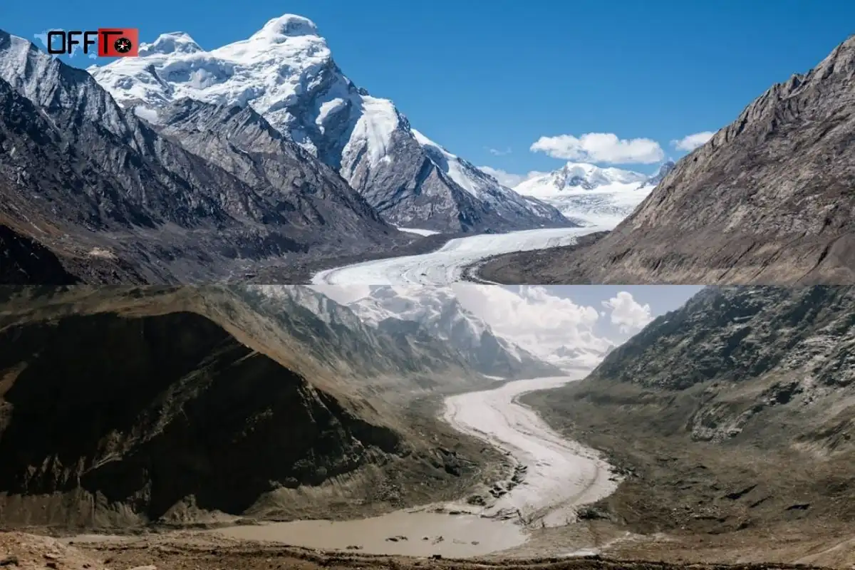
The Pindar River origin
The glacier is the source of the Pindar River, which flows through the valleys and contributes to the Ganges river system. This makes Pindari Glacier significant for both natural history and scenic value.
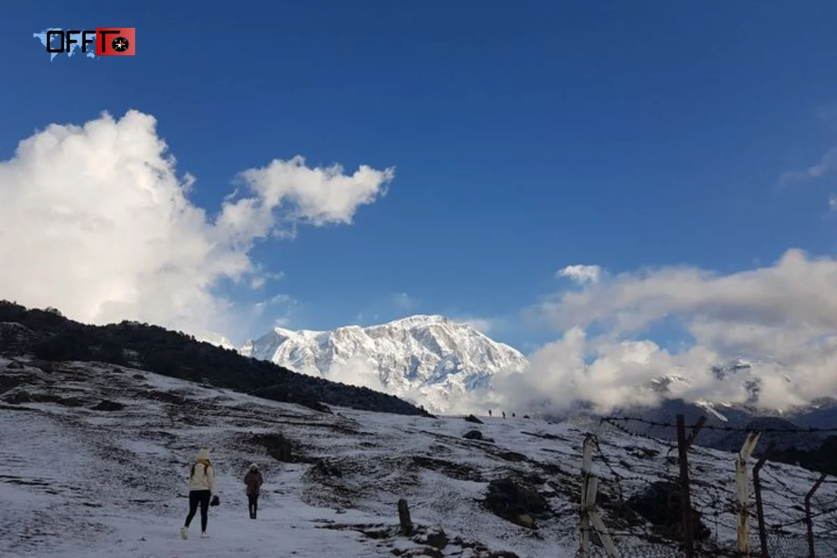
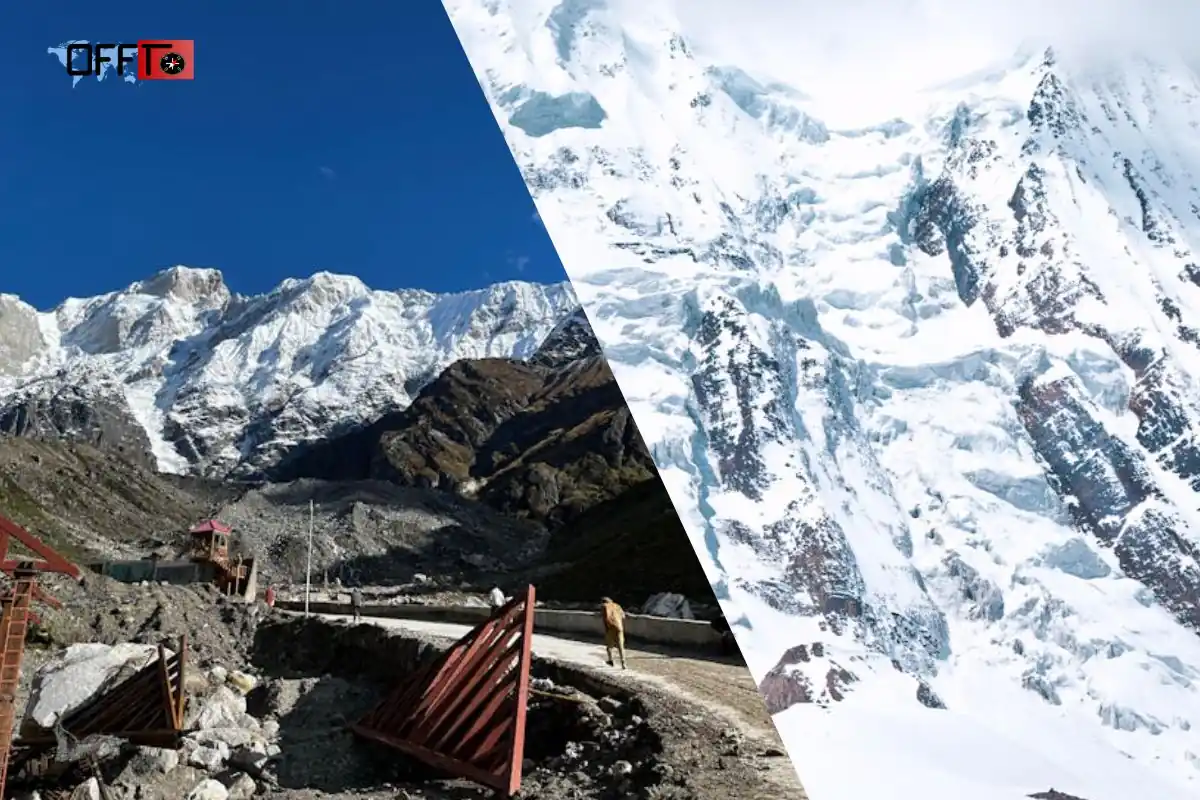
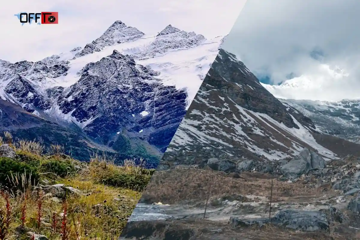
Zero Point and the glacier-snout view
The trek culminates at Zero Point, where visitors can witness the glacier snout and surrounding peaks. This location is particularly famous for sunrise photography and panoramic mountain vistas.
Why the trek appeals to first-time Himalayan trekkers
The trail is moderate in difficulty, allowing first-time trekkers to experience Himalayan adventure, glacier exploration, and high-altitude landscapes without extreme risk. The combination of nature, culture, and accessible trekking makes it a favorite for weekend or extended trips.
Pindari Glacier Zero Point: What Travellers Actually See

What is Pindari Glacier Zero Point?
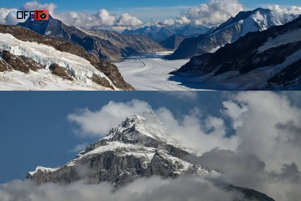
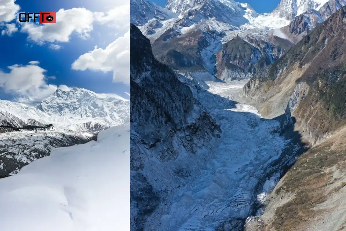
Zero Point is the furthest accessible point of the Pindari Glacier trek. It is where trekkers can view the glacier snout, surrounding Himalayan peaks, and the Pindar River origin. This location offers a 360-degree alpine experience, making it the highlight of the entire trek.
Is Zero Point the glacier itself?
While Zero Point provides a close-up view of the glacier snout, it is not the entire glacier. Trekkers can see ice formations, snow patches (season-dependent), and the valley feeding into the Pindar River, but venturing beyond this requires technical mountaineering.
How far is Zero Point from Phurkia?
From Phurkia, a common campsite and base during the trek, Zero Point is approximately 6–7 km uphill, taking 3–4 hours of moderate trekking depending on fitness, weather, and breaks for photography or rest.
What is the height of Pindari Glacier Zero Point?
Zero Point stands at an elevation of around 3,680 meters (12,073 feet) above sea level. This altitude offers breathtaking Himalayan views while remaining manageable for first-time trekkers with moderate acclimatization.
Best time of day to reach Zero Point
Early morning arrivals are ideal for clear visibility, cooler temperatures, and sunrise photography. Afternoon visits can bring fog and reduced visibility, especially during post-monsoon and monsoon seasons.
Can travellers go beyond Zero Point?
Venturing beyond Zero Point is not recommended for casual trekkers. Beyond this point, the trail is steeper, icy, and unmarked, requiring mountaineering experience and specialized gear. For most travelers, Zero Point provides the perfect scenic experience without the risks.
Which River Originates from Pindari Glacier?
Origin of the Pindar River
The Pindar River originates directly from the Pindari Glacier, fed by melting ice and seasonal snow. This river flows through the Almora and Bageshwar districts, forming the lifeline of the surrounding valleys and enriching the trekking experience with verdant riverbanks and cascading streams.
Where does the Pindar River meet the Alaknanda?
After flowing through the Pindari valley and surrounding Himalayan terrain, the Pindar River eventually joins the Alaknanda River near Karnaprayag, becoming part of the Ganges river system. This connection highlights the geographical and ecological importance of the glacier.
Why the river matters to the trekking experience
The Pindar River adds natural beauty and adventure to the trek. Trekkers cross its tributaries, small streams, and waterfalls, making the trail refreshing and visually stunning. It also serves as a natural guide through the valley, marking the progression toward Zero Point and the glacier snout.
Is Pindari Glacier Trek Difficult?
Not all Himalayan treks are equal. Here we introduce the difficulty level, terrain challenges, and stamina requirements. It’s the section that helps you gauge whether this trek fits your fitness and trekking experience.
Difficulty level in simple terms
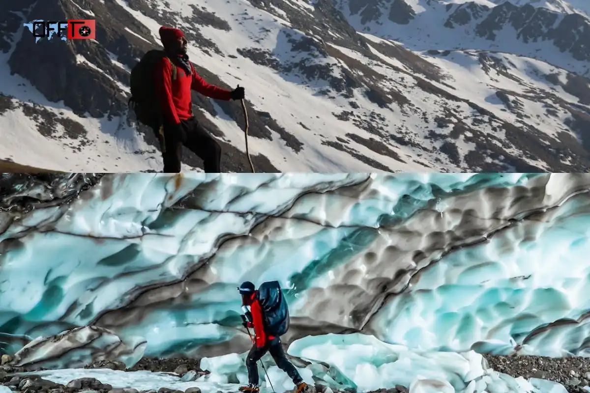
The Pindari Glacier trek is considered moderate in difficulty. While it doesn’t require technical climbing, trekkers face long walking distances, uphill stretches, river crossings, and rocky terrain, which demand endurance and basic trekking experience.
Is Pindari Glacier trek suitable for beginners?
Yes, beginner trekkers can attempt it, provided they have good stamina, proper guidance, and acclimatization. The trail is well-marked, and local guides make the trek safer for first-time Himalayan adventurers.
Long walking days and stamina requirements
Trekkers can expect 6–8 hours of walking daily, especially between Khati, Dwali, and Phurkia. Regular breaks, light backpacks, and proper pacing are essential for comfort and energy management.
Landslide-prone, slippery and exposed sections
Certain parts of the trek, particularly monsoon trails and river-crossing areas, are slippery and prone to landslides. Extra caution is required during wet conditions, and wearing good trekking shoes is strongly recommended.
Altitude considerations
Zero Point stands at 3,680 meters (12,073 ft). While altitude sickness risk is lower than extreme Himalayan peaks, trekkers should monitor symptoms, stay hydrated, and avoid sudden exertion.
Who should reconsider the trek?
- Very young children, senior citizens, or travelers with heart/lung conditions.
- Those uncomfortable with rocky paths, long uphill walks, or river crossings.
- Individuals expecting easy forest trails or casual day hikes may find the trek physically demanding.
Pindari Glacier Trek Route: Khati, Dwali, Phurkia and Zero Point
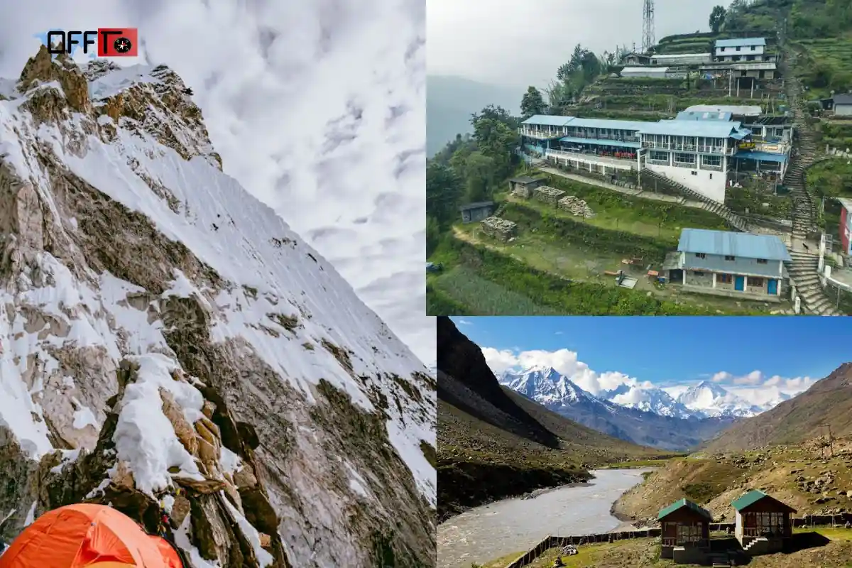
Reaching Khati village
Khati village is the primary base camp for the trek. It is accessible by shared taxis or private vehicles from Bageshwar or Loharkhet, offering accommodation, basic amenities, and starting points for trekking trails.
Khati to Dwali: forest trails, streams and long walking hours
The trail from Khati to Dwali passes through dense pine and oak forests, along the Pindar River, with small stream crossings. Trekkers experience long walking hours on moderate inclines, making early morning starts ideal.
Dwali to Phurkia: climbing toward the tree line
From Dwali to Phurkia, the trail ascends closer to the tree line, offering panoramic valley views. This stretch has rocky paths and moderate inclines, where trekkers should pace themselves for safety and energy management.
Phurkia to Zero Point: early-morning glacier approach
The final leg from Phurkia to Zero Point is steeper and often foggy in early hours. Trekkers aim to reach Zero Point by sunrise, providing the best visibility of the glacier snout and Himalayan peaks.
Returning through the same valley
The return trek follows the same valley route, allowing trekkers to enjoy the river, forest, and village scenery in reverse. It’s slightly faster as the trail is downhill but still requires care with slippery sections.
Where the Kafni route separates from the Pindari route
At a junction near Phurkia, the Kafni Glacier trail diverges from the Pindari route, leading to higher elevations and technical climbing sections. Casual trekkers and first-timers typically stay on the Pindari Glacier route, which is moderate and safer.
At a junction near Phurkia, the Kafni Glacier trail diverges from the Pindari route, leading to higher elevations and technical climbing sections. Casual trekkers and first-timers typically stay on the Pindari Glacier route, which is moderate and safer.
How Many Days Are Needed for the Pindari Glacier Trek?
Shorter itinerary vs classic route itinerary
The Pindari Glacier trek can be completed in 2–3 days for the shorter itinerary, which covers Khati to Zero Point and back. The classic 4–5 day route allows for a more relaxed pace, including Dwali and Phurkia stops, village exploration, and photography breaks. Longer itineraries enhance enjoyment of Himalayan landscapes without fatigue.
Why rushing the trek is a poor idea
Rushing increases the risk of fatigue, slips, and missing scenic spots. Trekkers often underestimate the terrain, river crossings, and weather delays. A hurried schedule also reduces time for Zero Point sunrise, glacier photography, and rest at base camps.
Recommended pacing for first-time trekkers
First-time Himalayan trekkers should allow at least 3–4 days, covering Khati, Dwali, Phurkia, and Zero Point at a moderate pace. Plan daily walking hours of 5–6 hours, with breaks for hydration, photography, and acclimatization.
Extra buffer day for weather or route disruption
Adding an extra day is recommended during monsoon or post-monsoon seasons, as trails can be slippery, foggy, or waterlogged. This buffer ensures safety, stress-free trekking, and better enjoyment of scenery.
How Do I Go to Pindari Glacier Trek?
Kathgodam to Bageshwar
Most trekkers begin from Kathgodam, the nearest railhead. From Kathgodam, it’s approximately 120 km to Bageshwar, usually covered by private taxi, bus, or shared jeep services.
Bageshwar to the current roadhead
From Bageshwar, travelers reach the trek starting points at Loharkhet or Dhakuri. The road passes through villages, forests, and river valleys, offering scenic views en route.
Reaching Khati village
Khati village is the base camp for the Pindari Glacier trek, with small lodges and camping options. It serves as the trailhead for Dwali, Phurkia, and Zero Point.
Nearest railway station
Kathgodam railway station is the closest major railhead. From there, private taxis or buses provide road access to Bageshwar and Khati village.
Nearest airport
Pantnagar Airport (~200 km) and Dehradun Airport (~300 km) are the nearest airports. Both require road transfers of 4–6 hours to reach the trek base.
Private vehicle, shared transport or trek-operator transfer?
Travelers can opt for self-drive or private taxi for flexibility. Shared jeeps or buses are budget-friendly, while trek operators often provide transfers, permits, and guidance, ideal for first-time trekkers.
Why travellers should keep a buffer day
A buffer day accounts for weather delays, river swelling, or minor injuries. It ensures that the trek is safe, relaxed, and enjoyable, allowing travelers to fully experience Zero Point, glacier views, and Himalayan scenery.
Where to Stay During the Pindari Glacier Trek
Planning a stay in Bageshwar
Bageshwar, about 90–100 km from Khati, is the most common pre-trek base town. Here, travelers can find budget hotels, guesthouses, and lodges. Staying in Bageshwar is ideal for early morning departures, last-minute supplies, and acclimatization before starting the trek.
Village stays around Khati
Khati village offers homestays, small lodges, and local guesthouses close to the trek start. Staying here lets trekkers begin the trek early, enjoy local Kumaoni cuisine, and experience traditional Himalayan village life.
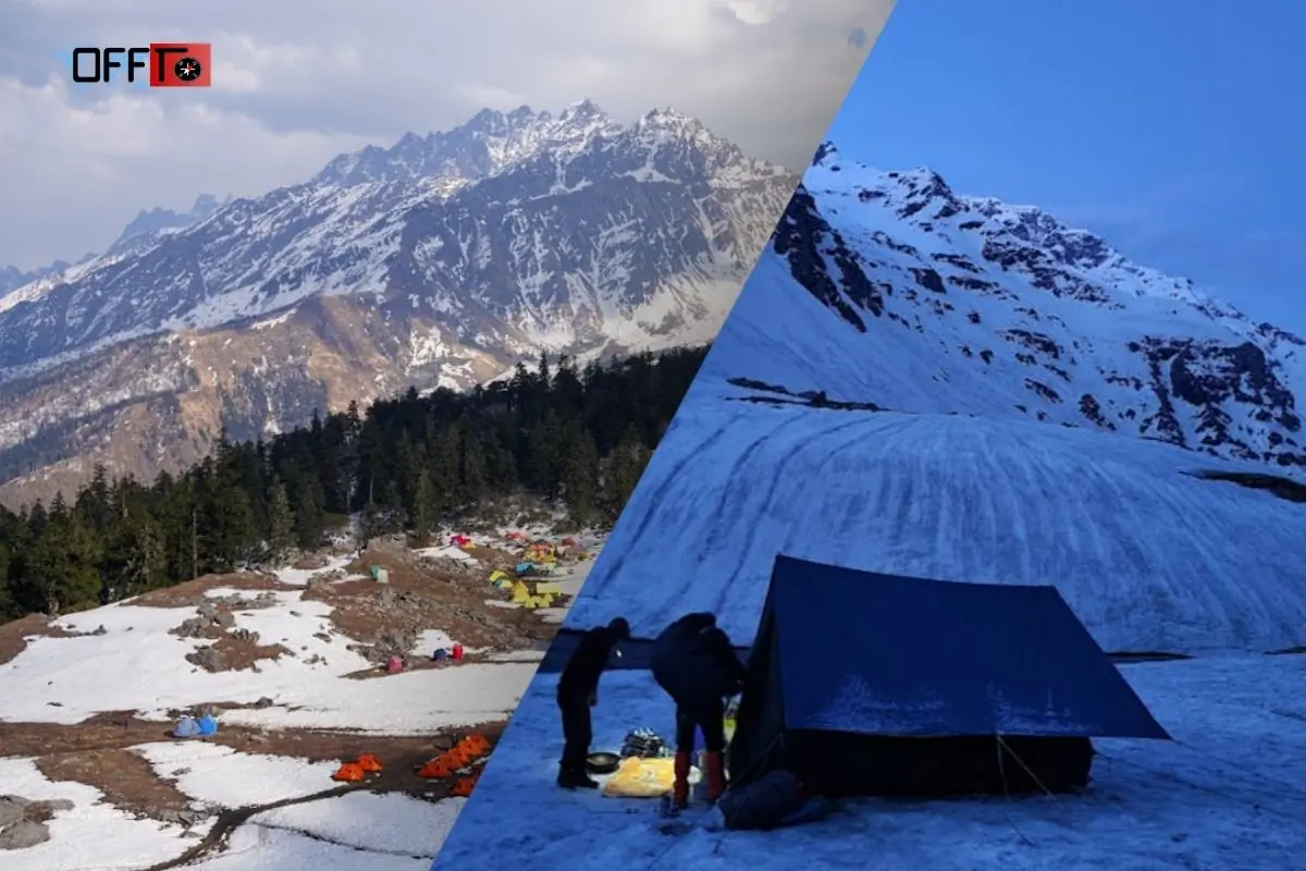
Trekking huts, camps and limited facilities
Along the trail, trekking huts and basic camping options are available at Phurkia and Dwali. These have minimal facilities—often only sleeping mats and shared wash areas—so travelers should carry essential gear and personal items.
What to confirm before departure
Before leaving for the trek, confirm:
- Availability of rooms or camps at Khati or Phurkia
- Booking with local guides or operators
- Meal options, especially during monsoon or post-monsoon
- Access to potable water and charging points
Why travellers should not assume last-minute availability
Accommodation along the trail is limited and fills quickly during peak seasons (post-monsoon and winter). Planning and pre-booking stays or camping slots ensures a safe, comfortable, and stress-free trek.
What to Pack for the Pindari Glacier Trek
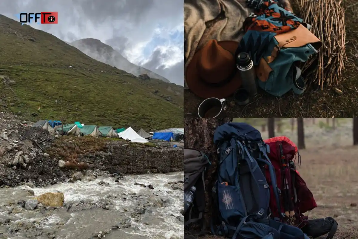
Footwear and trekking poles
Sturdy trekking shoes or boots with grip are essential for rocky, muddy, and slippery trails. Trekking poles help maintain balance, especially during river crossings and steep ascents.
Layering for changing weather
Temperatures vary significantly: mornings are chilly at base camps, afternoons are mild in valleys, and Zero Point can be cold and windy. Layering with thermal wear, fleece, and waterproof outerwear is key.
Rain protection
A poncho, rain jacket, or waterproof backpack cover is crucial during monsoon or post-monsoon trekking, protecting both trekkers and gear from sudden showers.
Water, snacks and personal essentials
Carry at least 2–3 liters of water, high-energy snacks, and personal hygiene items. Hydration and energy management are essential on long walking days.
Basic medical kit
A small kit with band-aids, antiseptic, painkillers, anti-altitude meds, and basic prescriptions can help handle minor injuries, blisters, or altitude-related discomfort.
Headlamp, power bank and offline navigation
Essential for early morning or late return treks, a headlamp or flashlight, fully charged power bank, and offline maps or GPS ensure safety and route tracking, especially if guides are unavailable.
What beginners often forget
First-time trekkers often forget extra socks, insect repellent, sunscreen, and a small towel. Keeping dry bags for electronics and important documents is highly recommended, particularly for river-crossing sections.
Expectation vs Reality: What the Pindari Glacier Trek Is Really Like
Accessible glacier trek does not mean effortless trek
While Pindari Glacier is considered an accessible Himalayan trek, it still requires physical stamina and preparation. The trails involve river crossings, uphill walks, and uneven terrain, so trekkers should avoid assuming it’s a casual or flat hike.
Zero Point is a viewpoint, not a casual glacier walk
Zero Point offers the best views of the glacier snout, but it is not a walk-on glacier. Trekkers cannot traverse the glacier itself without mountaineering experience and technical gear, so treat it as a scenic viewpoint rather than a glacier expedition.
Facilities become limited after the road journey
Beyond Dhakuri or Loharkhet, infrastructure is minimal. Trekking huts or camps along Dwali and Phurkia provide basic shelter, but restaurants, medical facilities, and shops are absent, so preparation is essential.
Weather can disrupt a carefully planned itinerary
Weather in the Kumaon Himalayas can change rapidly. Heavy rainfall, fog, or landslides may delay trekking times, reduce visibility at Zero Point, or require extra caution on slippery trails. Always plan with a buffer day.
The village trail experience is part of the attraction
Walking through Khati and other Kumaoni villages gives trekkers a unique cultural experience. Observing local life, traditional architecture, and forest-edge settlements enriches the trek beyond just glacier views.
Why slow pacing improves the experience
Taking the trek slowly allows travelers to acclimatize, enjoy scenic spots, and reduce fatigue. Pausing for photography, river views, and wildlife spotting enhances the overall Himalayan trekking experience and safety.
FAQs
Where is Pindari Glacier located?
Pindari Glacier is located in Uttarakhand, India, within the Kumaon region of the Himalayas. It lies in the Bageshwar district and is accessed through villages like Loharkhet and Dhakuri. Nestled in a scenic valley, it is part of the western Kumaon Himalayas, offering trekkers access to glacier views, alpine streams, and Himalayan peaks. This location makes it ideal for 2–3 day trekking trips rather than casual day visits.
Which river originates from Pindari Glacier?
The Pindar River originates from Pindari Glacier. It flows down the valleys, providing scenic riverside trekking paths and eventually joins the Alaknanda River near Karnaprayag. The river’s origin adds to the trek’s charm, creating small waterfalls, streams, and natural pools that make the trail visually stunning and enriching for first-time Himalayan trekkers.
What is Pindari Glacier Zero Point?
Zero Point is the farthest accessible point of the Pindari Glacier trek. It offers glacier snout views and panoramic Himalayan scenery. Trekkers can observe ice formations, snow patches, and surrounding peaks, but walking on the glacier itself requires technical climbing skills. Zero Point is often the highlight of the trek, especially for photography and sunrise visits.
What is the height of Pindari Glacier Zero Point?
Zero Point stands at approximately 3,680 meters (12,073 feet) above sea level. At this altitude, trekkers experience alpine weather, snow patches in colder months, and breathtaking Himalayan panoramas. While not extremely high compared to Himalayan peaks, it offers first-time trekkers a manageable yet rewarding high-altitude experience.
Is the Pindari Glacier trek difficult?
The Pindari Glacier trek is moderate in difficulty. It involves long walking days, river crossings, slippery sections, and uphill climbs, but does not require technical mountaineering. Trekkers need good stamina, proper footwear, and basic trekking experience, especially during monsoon or post-monsoon seasons when trails can be slippery and waterlogged.
Is the Pindari Glacier trek suitable for beginners?
Yes, the trek is beginner-friendly if planned carefully. First-time trekkers can attempt it with guides, proper pacing, and sufficient acclimatization. While the trail has moderate inclines and long walking hours, it is safe for newcomers who follow instructions, maintain hydration, and carry essential gear. Beginners should avoid rushing and allow buffer days.
What is the total distance of the Pindari Glacier trek?
The total trek distance varies depending on the route but is typically 90–100 km round-trip from Loharkhet or Dhakuri to Zero Point and back. Some sources list slightly different distances due to starting points, side trails, or trekking loops, but most trekkers cover the journey in 3–5 days including breaks.
Why do different websites show different Pindari Glacier trek distances?
Distance variations occur because websites measure from different base villages like Loharkhet, Dhakuri, or Bageshwar. Some include side trails to Dwali, Phurkia, or camping points, while others report only the direct route to Zero Point. Trek conditions, seasonal detours, and updated paths can also affect reported distances.
How many days are required for the Pindari Glacier trek?
A typical Pindari Glacier trek takes 3–4 days for a moderate pace, covering Khati, Dwali, Phurkia, and Zero Point. Experienced trekkers can attempt a shorter 2–3 day itinerary, but first-timers are recommended to plan extra buffer days for acclimatization, weather changes, and enjoying scenery.
What is the best time to visit Pindari Glacier?
The best time to visit Pindari Glacier is post-monsoon (October to November) and winter (December to February). Rivers are full, trails are stable, and visibility at Zero Point is excellent. Monsoon offers lush scenery but slippery trails, while summer is warmer but less dramatic, making planning based on comfort and safety essential.
Is the Pindari Glacier Trek Worth It?
The Pindari Glacier trek is ideal for first-time Himalayan trekkers who are prepared with moderate stamina, proper gear, and guided support. Its well-marked trails, scenic river valleys, and glacier viewpoints provide a safe introduction to Himalayan trekking without extreme technical challenges.
Best for slow-adventure travellers
If you enjoy a leisurely pace with frequent stops for photography, nature observation, and local culture, this trek is perfect. Slow-adventure travelers can soak in the Himalayan landscapes, forest trails, and village experiences while avoiding rush and fatigue.
Best for travellers interested in Himalayan villages
The trek passes through Khati, Dwali, and other traditional Kumaoni villages, offering a cultural immersion into local Himalayan life. Visitors can experience village trails, local architecture, and small community interactions, making the journey as much about people and culture as the glacier.
Best for photographers and landscape lovers
With its Zero Point glacier snout, verdant valleys, waterfalls, and Himalayan peaks, Pindari Glacier is a dream destination for landscape photography. Sunrise, post-monsoon greenery, and river-fed streams create perfect natural frames for capturing the beauty of Kumaon Himalayas.
Who may not enjoy the trek?
Travelers expecting a luxury trek, urban conveniences, or short day hikes may find it challenging. Individuals with serious health issues, poor stamina, or fear of heights/rough terrain should reconsider. The trek demands moderate endurance, planning, and weather preparedness.
When to choose a shorter Uttarakhand trek instead
If time is limited or you prefer less strenuous trails, consider shorter treks in Uttarakhand like Kuari Pass, Deoriatal, or Roopkund base hikes. These treks offer scenic Himalayan views with shorter distances, suitable for families or first-time trekkers with minimal hiking experience.
Plan Your Pindari Glacier Trek with Offto Travellers
Ready to turn your Pindari Glacier trek into a well-planned Kumaon adventure? Offto helps you explore Uttarakhand book stays, local activities, and slow-travel experiences that fit around your trekking schedule.
Compare options for base camps at Khati, Dhakuri, or nearby villages.
Build a realistic itinerary including buffer days for weather or trail delays.
Mix trekking with village walks, photography spots, and nature trails for a richer experience.
Add pre- or post-trek stays to enjoy forest trails, Himalayan scenery, and river views without rushing.
Use Offto Travellers to customize your trip, make informed choices on stays and activities, and ensure a safe, enjoyable, and stress-free Pindari Glacier adventure.
Sign up
Leave a Reply