
Pin Parvati Trek is a demanding high-altitude crossover between Parvati Valley and Pin Valley in Himachal Pradesh. Reaching approximately 17,450 ft, it involves long trekking days, remote terrain, glaciers and steep sections. It is best suited to experienced high-altitude trekkers.
Where Is Pin Parvati Pass Located?
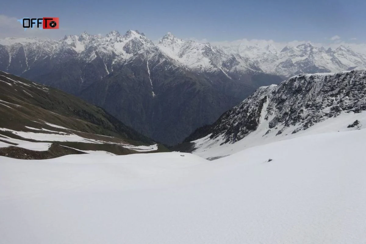
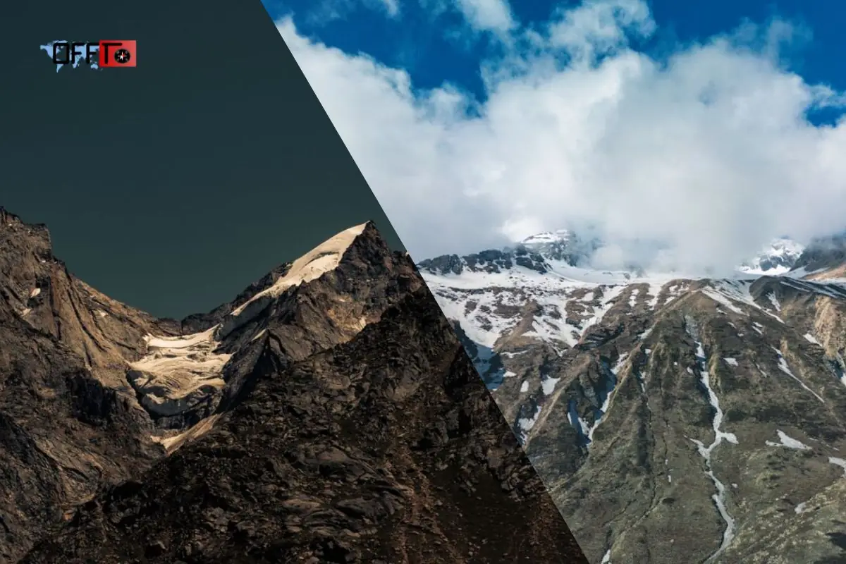
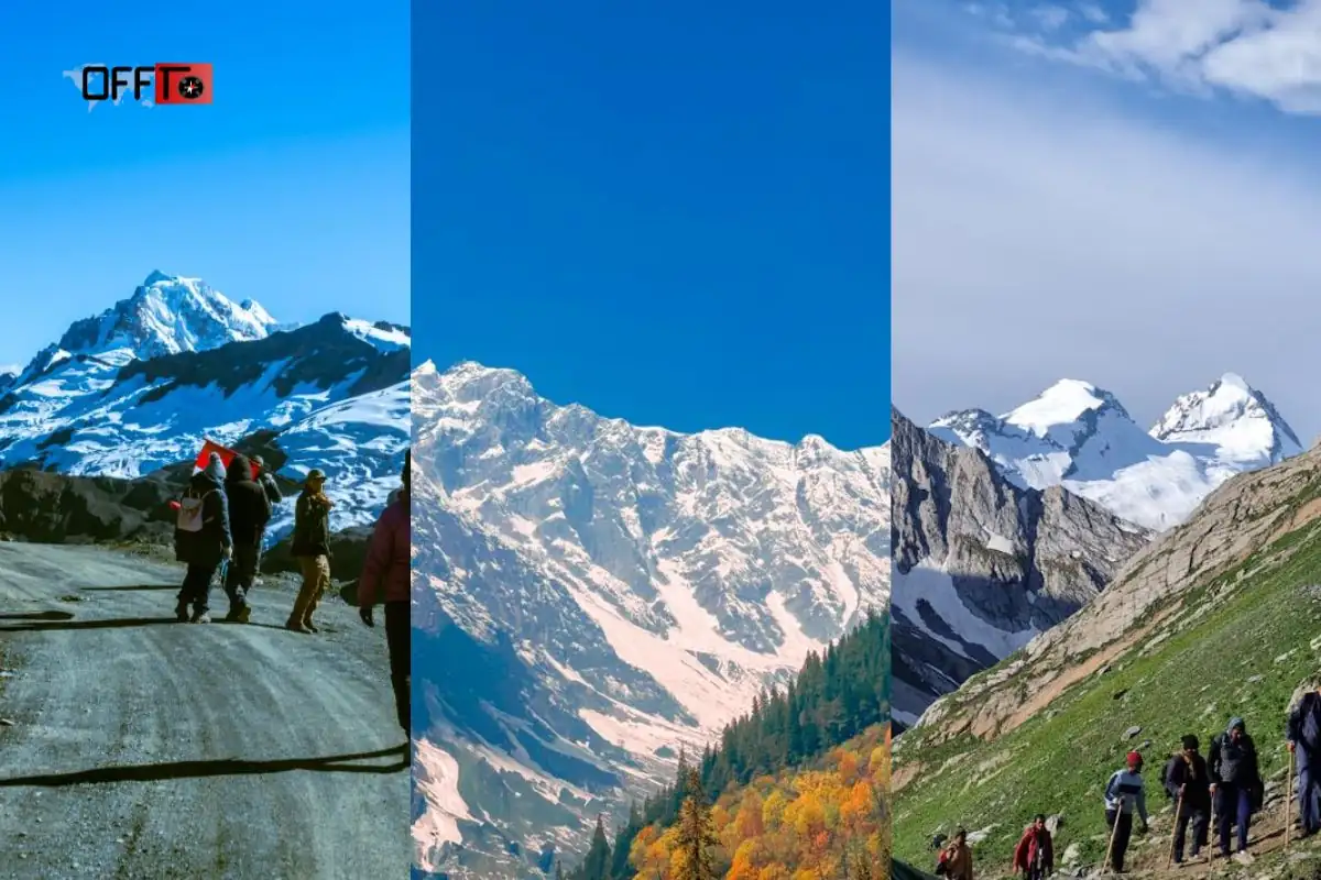
Pin Parvati Pass in Himachal Pradesh
Pin Parvati Pass is located in Himachal Pradesh and forms a high-altitude crossover between Parvati Valley in Kullu and Pin Valley in Spiti. This is what makes the pin parvati trek different from a regular valley hike. It is not limited to one landscape or one travel mood. The route moves from green forested terrain into colder, drier, and more remote Himalayan country.
How the Pass Connects Parvati Valley in Kullu with Pin Valley in Spiti
The trek usually begins on the Kullu side, around Barshaini or nearby access points in Parvati Valley. From there, the trail moves through Kheerganga, Tunda Bhuj, Thakur Kuan, Odi Thach, Mantalai Lake, and the higher camps before reaching Pin Parvati Pass. After crossing the pass, the route descends into Pin Valley and continues towards Mudh and Kaza.
This connection is the heart of the pin parvati pass trek. Trekkers are not simply gaining altitude; they are crossing between two distinct Himalayan regions with different terrain, weather patterns, and visual character.
Why the Crossover Creates a Dramatic Landscape Transition
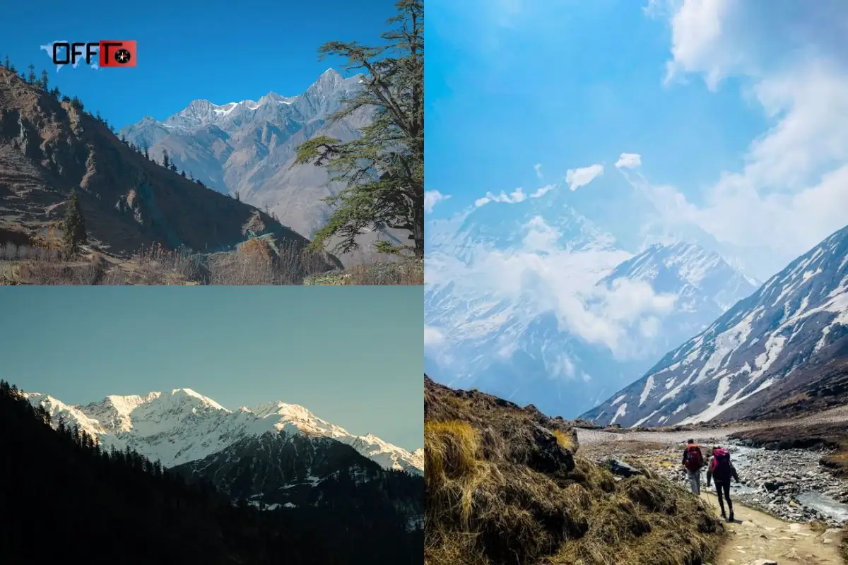
The Parvati side is greener, wetter, and more enclosed, with forests, streams, meadows, and river sections. The Pin Valley side feels wider, drier, colder, and more exposed. This sudden shift gives the trek its strong crossover identity.
For many trekkers, this transition is the most memorable part of the journey. The trail begins with the familiar richness of Parvati Valley trek landscapes and slowly turns into the stark, high-altitude beauty associated with Spiti.
How Mudh and Kaza Fit Into the Onward Journey
Mudh is usually the first major settlement reached after descending into Pin Valley. Kaza then becomes the main onward road-head for many itineraries. Some packages may end at Mudh, while others include the drive to Kaza, Manali, or another departure point.
Before booking, always check where your pin parvati trek package actually ends. This affects travel time, cost, road-transfer planning, and whether you need an additional buffer day.
Pin Parvati Trek Route: From Parvati Valley to Pin Valley
The Broad Crossover Journey
The Pin Parvati Trek route is a demanding crossover from Parvati Valley into Pin Valley. A typical route moves from Barshaini towards Kheerganga, Tunda Bhuj, Thakur Kuan, Odi Thach, Mantalai Lake, the higher pass approach, Pin Parvati Pass, Pin Base or Bedu Thatch, Tiya, Mudh, and then towards Kaza.
This route should be understood as an expedition-style journey, not a casual walking trail. Distances, camp names, and road-transfer points may vary across operators, so the day-wise itinerary must be checked carefully before booking.
Forested Lower Trails
The lower trail usually begins with forested sections, river sounds, wooden bridges, and gradual altitude gain. These early stages may feel familiar to travelers who have explored the Parvati Valley region, but they should not be mistaken for the full difficulty of the pin parvati pass trek.
The first few days are about controlled pacing. Starting too fast can affect recovery later, especially as the trail moves towards higher and more remote terrain.
Meadows and River Sections
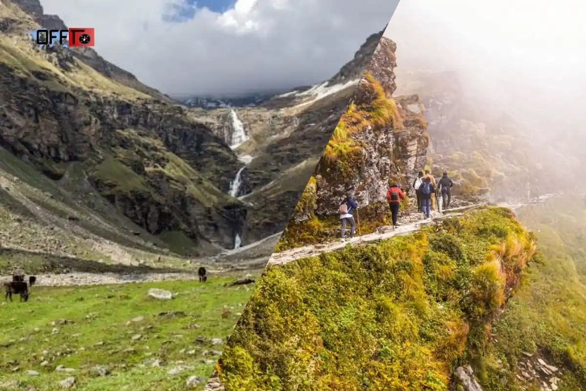
As the route gains height, the landscape opens into meadows, grazing grounds, and long river-side stretches. This middle section is beautiful but physically demanding. Trekkers may face wet trails, boulder patches, stream crossings, and long walking hours.
This is where the trek begins testing endurance. The effort per kilometre increases because of uneven terrain, altitude gain, and repeated exposure to changing trail conditions.
Mantalai Lake and the Upper Valley
Mantalai Lake is one of the most important landmarks on the pin parvati trek. It lies in the upper valley and often acts as a major transition point before the terrain becomes more serious.
Beyond this region, the route moves into colder, rougher, and more isolated sections. The approach to the pass requires careful pacing, strong acclimatization, and close attention to weather and group condition.
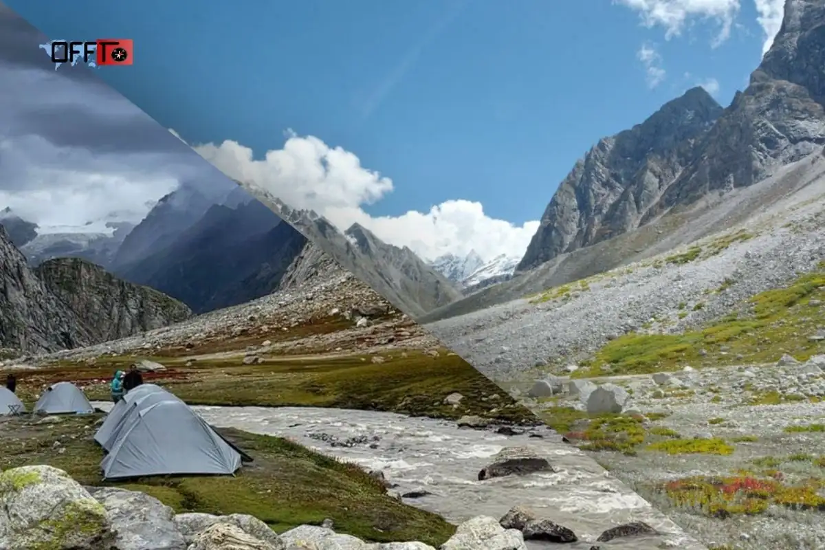
Glacier and Moraine Terrain Near the Pass
The terrain near Pin Parvati Pass can include moraine, glacier-influenced ground, snow patches, or ice-field sections depending on the season. This is the most demanding part of the route and should be handled only with experienced guides.
The pass-crossing day usually involves an early start, steep ascent, thin air, rough footing, and a long descent. Reaching the pass is not the end of the challenge; the descent afterwards can be equally tiring.
The Transition Into the Drier Landscapes of Pin Valley
After crossing the pass, the route enters the drier and more exposed terrain of Pin Valley. The landscape becomes wider, quieter, and visually more rugged. This contrast is one of the reasons the trek is considered one of Himachal’s most dramatic crossover routes.
The shift from green Parvati Valley to the stark Spiti-side terrain gives the pin parvati pass trek its strongest visual and emotional identity.
Mudh and the Onward Drive Towards Kaza
Mudh usually marks the end of the major trekking section on the Pin Valley side. From here, many itineraries continue by road towards Kaza. This road-transfer stage should not be ignored while planning, because mountain drives can be long and tiring after several days of trekking.
A useful pin parvati trek map should show both the walking route and the vehicle transfers. It should also mark campsites, altitude gain, pass-crossing day, Mudh, and Kaza.
Pin Parvati Trek Map and Elevation
Route Map with Major Campsites
A proper Pin Parvati Trek map should do more than show a line between two valleys. It should clearly mark the full crossover from the Parvati Valley side to the Pin Valley side, including the major campsites, altitude changes, pass-crossing day and road-transfer points. For a trek as remote and demanding as this, the map is not just a visual extra; it is a planning tool.
A useful map for the pin parvati trek should ideally mark Barshaini or the selected starting point, Kheerganga, Tunda Bhuj, Thakur Kuan, Odi Thach, Mantalai Lake, Summit Camp, Pin Parvati Pass, Pin Base or Bedu Thatch, Tiya, Mudh and Kaza. These points help trekkers understand how the route gradually moves from the greener Kullu side into the colder and drier Spiti-side terrain.
Altitude Progression Across Trekking Days
The elevation gain on the Pin Parvati Pass Trek is one of the main reasons it should not be treated like a casual Himalayan trail. The route begins with relatively lower-altitude forest and valley sections before moving into meadows, upper valley camps, moraine zones and the high pass area. Each day adds physical pressure, especially as oxygen levels reduce and the terrain becomes rougher.
A good elevation profile shows where the body will start feeling the altitude more seriously. It also helps trekkers understand why the itinerary must not be rushed. On this trek, safe progress is not only about covering distance; it is about giving the body time to adjust before reaching the highest section near Pin Parvati Pass.
Trekking Stages Versus Vehicle Transfers
One common mistake while reading a pin parvati trek map is assuming that every marked section is walked. In most itineraries, the journey includes both trekking stages and vehicle transfers. The walking route usually runs from the Parvati Valley side across the pass and down towards the Pin Valley side, while road movement may be included before the trek starts and after reaching Mudh or Kaza.
This distinction matters because total duration can look different across operators. Some packages count arrival, transfer and departure days. Others highlight only the core trekking days. Before booking, check whether the map separates walking distance from road travel.
Where the Pass-Crossing Day Sits Within the Itinerary
The pass-crossing day usually comes after several days of gradual movement through the Parvati Valley, upper camps and high-altitude approach sections. This placement is important because it allows trekkers to build rhythm before facing the most demanding part of the pin parvati pass trek.
The day of crossing Pin Parvati Pass should be treated as the hardest stage of the route. It can involve an early start, steep ascent, snow or ice-field sections, moraine terrain, high-altitude fatigue and a long descent on the other side. Seeing this day clearly marked on the map helps trekkers understand why preparation, pacing and weather judgment matter so much.
Why an Elevation Profile Is More Useful Than a Simple Trail Line
A simple map shows where the trail goes. An elevation profile shows how hard the trail may feel. This is especially important for the pin parvati trek because the route changes constantly: forest paths, river sections, meadows, boulder zones, moraine, glacier-influenced terrain and dry Spiti-side descents all demand different levels of effort.
For serious planning, trekkers should look at both the route map and the elevation profile. The route map explains direction. The elevation profile explains pressure points. Together, they give a much clearer idea of how the trek unfolds day by day.
Key Places to Mark on the Pin Parvati Trek Map
Barshaini
Barshaini is commonly used as the access point on the Parvati Valley side. Depending on the operator, the actual pickup or start may be listed as Bhuntar, Kasol, Barshaini or a nearby village. Trekkers should confirm the exact reporting point before travel, especially if they are arranging transport independently.
Kheerganga
Kheerganga is one of the early landmarks on many Pin Parvati itineraries. It is better known among casual Parvati Valley travelers, but on this route it works as an early stage before the trail becomes more remote and demanding.
Tunda Bhuj
Tunda Bhuj marks the journey deeper into the valley. By this stage, the trek starts feeling more expedition-like, with longer walking hours and greater distance from easy road access.
Thakur Kuan
Thakur Kuan is an important middle-stage campsite. The terrain around this part of the route can include river-side walking, uneven ground and sections where careful foot placement matters.
Odi Thach
Odi Thach is often associated with open meadow landscapes and steady ascent. It is one of the stages where trekkers begin to feel the accumulated effort of consecutive walking days.
Mantalai Lake
Mantalai Lake is a major landmark on the pin parvati pass trek. It sits in the upper valley and signals that the route is moving closer to the more demanding high-altitude sections before the pass.
Summit Camp
Summit Camp is generally placed before the pass-crossing day. This is a critical point in the itinerary because trekkers need rest, hydration and energy conservation before the toughest stage of the journey.
Pin Parvati Pass
Pin Parvati Pass is the highest and most demanding point of the crossover. It connects the Parvati Valley side with the Pin Valley side and gives the trek its identity as a serious high-altitude Himalayan crossing.
Pin Base or Bedu Thatch
After crossing the pass, trekkers descend towards the Pin Valley side. Depending on the itinerary, Pin Base or Bedu Thatch may appear as the next major camping area after the pass-crossing stage.
Tiya
Tiya is usually part of the descent through the drier Spiti-side landscape. By this stage, the visual character of the trek has changed sharply from the greener Parvati side.
Mudh
Mudh is one of the most important exit-side villages on the Pin Valley route. For many trekkers, it marks the end of the main walking section and the beginning of the road journey towards Kaza.
Kaza
Kaza is the main onward hub in Spiti for many Pin Parvati Trek itineraries. Some packages include the drive to Kaza, while others may define the trek ending differently. Always check this before booking.
Pin Parvati Trek Distance and Duration
Why Different Itineraries Show Different Distances
The pin parvati trek distance is not presented the same way by every operator. Some itineraries include only the core walking trail, while others include approach sections, exit sections or broader route estimates. This is why one source may mention around 80 km, while another may describe the route closer to 100–110 km.
The difference does not always mean one itinerary is wrong. It usually reflects how the route has been measured, where the trek is considered to begin and end, whether road sections are excluded, and how campsites are placed.
Typical Distance Range Across Packages
For planning purposes, trekkers should treat Pin Parvati as a long, demanding crossover rather than focusing on one exact number. Many current operator-style itineraries describe the trek as roughly 10–11 days, with the broader route often placed around 100–110 km. However, the practical effort depends more on terrain, altitude and daily pacing than the number alone.
A shorter listed distance does not automatically mean an easier trek. On this route, even a moderate-distance day can feel demanding because of altitude, rough ground, stream crossings or snow conditions.
Walking Days Versus Travel Days
The duration of the Pin Parvati Pass Trek usually includes a mix of trekking days and travel days. Some itineraries count the arrival day, drive to the base, trek days, exit drive and return journey. Others highlight only the walking stages.
This is why the same trek may appear as a 9-day, 10-day, 11-day or 12-day plan depending on how the package is structured. Before comparing prices or operators, check how many days are actual walking days and how many are road-transfer or reporting days.
Daily Distance Expectations
Daily distance on the pin parvati pass trek can vary widely. Some days may involve controlled walking through forest or meadow sections, while others can include long river-side stretches, rough boulder zones, high-altitude movement or a demanding pass-crossing stage.
Trekkers should expect consecutive walking days rather than isolated hard efforts. The challenge builds gradually. Fatigue from earlier stages can affect performance near the pass, which is why pacing in the first half of the trek is extremely important.
How Terrain Changes the Effort Required Per Kilometre
On flat ground, distance is easy to understand. In the Himalayas, one kilometre can feel very different depending on terrain. A kilometre through forest trail is not the same as a kilometre across moraine, wet rock, snow patches or loose descent.
This is especially true on the Pin Parvati Trek. The route includes forested lower trails, river sections, meadows, upper valley terrain, glacier-influenced ground and dry Spiti-side descents. Each terrain type changes speed, energy use and risk.
Why a Shorter Itinerary Is Not Automatically a Better Itinerary
A shorter Pin Parvati itinerary may look attractive because it saves time, but it can also reduce acclimatization and recovery. On a difficult high-altitude route, fewer days can mean longer walking stages, faster altitude gain and less flexibility if weather or trail conditions change.
For experienced trekkers, the better itinerary is usually the one that balances distance, altitude gain, safety, guide judgment and buffer time. Pin Parvati rewards patience. A well-paced route is more valuable than a rushed schedule.
Pin Parvati Pass Height and Altitude
Maximum Altitude in Feet and Metres
Pin Parvati Pass reaches roughly 17,450 feet, or around 5,300 metres, depending on the measurement used by different trek operators. This height places the pin parvati trek firmly in the high-altitude category and makes acclimatization a serious part of the journey, not a secondary detail.
At this altitude, trekkers may feel thinner air, slower recovery, reduced appetite, disturbed sleep and quicker fatigue. The pass height is one of the reasons the pin parvati pass trek is recommended only for experienced trekkers who already understand how their body responds at altitude.
Gradual Ascent Through Parvati Valley
The route usually builds altitude gradually from the Parvati Valley side. Early stages pass through forested trails, river sections, meadows and higher valley camps before the route moves closer to Mantalai Lake and the pass approach.
This gradual ascent is important because it allows the body to adapt over several days. However, gradual does not mean easy. The walking hours remain long, and the terrain becomes progressively more demanding as the trek moves deeper into the upper valley.
Higher Camps Before the Pass Crossing
The camps before the pass crossing are among the most important points in the itinerary. These higher camps prepare trekkers for the toughest day of the route, when the trail moves through steep, cold and often unstable high-altitude terrain.
By this stage of the pin parvati trek, good rest, hydration, nutrition and pacing matter more than speed. Trekkers should avoid overexertion before the pass day because fatigue can build quickly at altitude and affect performance when the route becomes more exposed.
Altitude Loss Towards Pin Valley
After crossing Pin Parvati Pass, the route descends towards the Pin Valley side. This altitude loss may sound like relief, but the descent can still be physically demanding. Trekkers may face rough footing, loose ground, tired legs and long walking hours after already spending energy on the ascent.
The landscape also changes sharply. The greener Parvati Valley gives way to the drier, wider terrain of Pin Valley. This change in altitude and geography is one of the defining experiences of the pin parvati pass trek.
Why Acclimatization Cannot Be Rushed
Acclimatization cannot be rushed on Pin Parvati because the route combines altitude, remoteness and difficult terrain. A shorter itinerary may look attractive, but faster altitude gain can increase fatigue and reduce safety margins.
A good itinerary should allow the body to adjust before the pass-crossing day. Trekkers should also watch for warning signs such as headache, nausea, dizziness, unusual breathlessness or poor coordination. On a remote trek like this, ignoring altitude symptoms can create serious problems because exit options are limited.
How Difficult Is Pin Parvati Trek?
Overall Difficulty: Difficult to Very Difficult
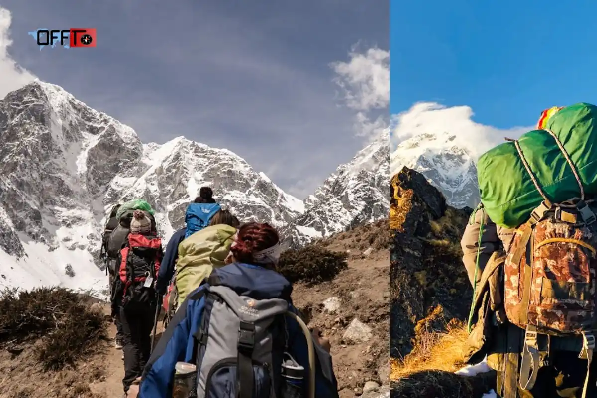
The pin parvati trek is generally considered difficult to very difficult. It is not suitable for beginners or casual travelers looking for a relaxed Himalayan holiday. The route involves high altitude, long trekking days, river crossings, boulder sections, moraine, glacier-influenced terrain and limited exit points.
The difficulty comes from the combination of several factors. Even if one section feels manageable, the accumulated strain of multiple hard days makes the trek demanding. This is why experience, fitness and mental steadiness are all important.
Long Walking Days
Long walking days are a major part of the pin parvati pass trek. Trekkers may need to walk for several hours on consecutive days, often on uneven or changing terrain. The challenge is not only one difficult day; it is the repeated effort required across the full route.
Good pacing is essential. Moving too fast in the early stages can cause fatigue later, especially before the pass-crossing day. The trek rewards steady movement, controlled breathing and disciplined energy management.
River Crossings and Wet Sections
The route can include river crossings, stream sections and wet trails, especially on the Parvati Valley side. These sections require patience and careful foot placement. Water levels may vary depending on rainfall, snowmelt and season.
Wet terrain also increases the risk of slips, cold feet and slower movement. Trekkers should be comfortable walking through changing trail conditions rather than expecting a dry, predictable path throughout the journey.
Boulder Zones, Moraine and Glacier Terrain
As the route moves higher, the trail can include boulder zones, moraine and glacier-influenced terrain near the pass. These sections are slower and more tiring than normal walking trails. Every step requires balance, attention and effort.
This type of terrain is one reason the pin parvati trek should be attempted with experienced guides. Route judgment matters, especially where the trail is unclear, unstable or affected by snow and weather.
Snow or Ice-Field Sections
Depending on the season and conditions, trekkers may encounter snow patches or ice-field sections near Pin Parvati Pass. These sections can make movement slower and more physically demanding. They may also require technical awareness from the guide team.
Trekkers should not assume that snow makes the trek only more scenic. Snow and ice can affect grip, pace, visibility and safety decisions. The operator’s experience becomes especially important in these sections.
Best Time for the Pin Parvati Pass Trek
Why Accessibility and Safety Determine the Season
The best time for the Pin Parvati Pass Trek is not decided only by pleasant weather. Accessibility and safety matter more. This is a high-altitude crossover where snow, river flow, rain, glacier conditions and visibility can change the route quickly. A month may look suitable on paper, but the final decision should always depend on current trail conditions.
For the pin parvati trek, the safest window is usually when the pass is accessible, snow levels are manageable, river crossings are possible and the team has enough daylight for long trekking days.
Typical Summer and Early-Autumn Trekking Window
Most Pin Parvati Pass Trek itineraries operate during the summer and early-autumn window, commonly between July and September. This is when the higher sections become more approachable after snow begins to melt, though conditions can still remain demanding.
July and August are often considered the core trekking months, while September may offer clearer skies in some years but colder conditions near higher camps. The exact timing should be checked close to departure because the route is sensitive to weather and seasonal variation.
How Snowmelt, Rain and Route Conditions Affect the Itinerary
Snowmelt can make the pass more accessible, but it can also increase stream flow and make river crossings more serious. Rain on the Parvati Valley side can create wet trails, slippery sections and slower walking. Higher up, snow patches, ice fields or moraine sections can still affect movement.
This is why a fixed itinerary should always have some flexibility. On a difficult trek like Pin Parvati, safety decisions may depend on weather, group pace and guide assessment rather than the printed schedule alone.
Why the Latest Operator Guidance Matters More Than a Fixed Month Label
A general best-season label is useful, but it is not enough for this trek. The latest operator guidance matters because local teams track snow bridges, stream crossings, campsite conditions, road access and weather windows more closely.
Before booking the pin parvati pass trek, ask whether the route has opened safely, whether the current batch has crossed recently, and what backup plan exists if conditions change near the pass.
Pin Parvati Trek Itinerary: A Realistic Day-by-Day Plan
Day 1: Reach the Starting Point and Prepare for the Trek
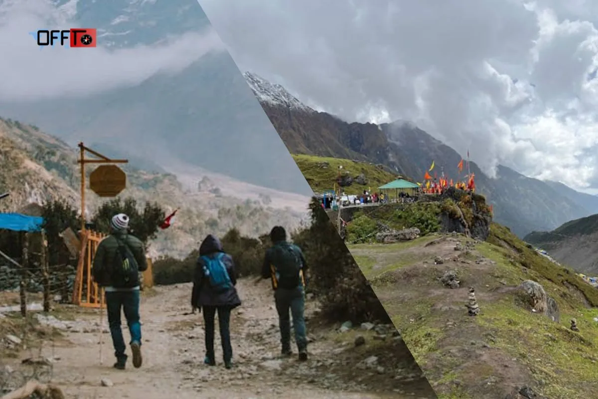
The first day is usually reserved for reaching the starting point, completing registration or briefing, checking gear and resting before the trek begins. Depending on the operator, the reporting point may be Bhuntar, Kasol, Barshaini or another nearby location.
This day should not be overloaded. Long road travel followed by poor sleep can affect the first trekking day. Use the evening to organize layers, rain protection, medicines, snacks and essentials.
Day 2: Trek Towards Kheerganga
The trek usually begins with forest trails, gradual ascent and familiar Parvati Valley terrain. This stage may feel manageable, but it should be approached with discipline.
The goal is not speed. Early pacing helps the body settle into trekking rhythm. Keeping the first walking day controlled reduces unnecessary fatigue before the route becomes longer and more remote.
Day 3: Kheerganga to Tunda Bhuj
The trail towards Tunda Bhuj usually feels longer and more serious. Trekkers move deeper into the valley, with river-side walking and changing terrain becoming more noticeable.
This is where the pin parvati trek starts moving beyond the mood of a regular Parvati Valley trek. Consecutive walking days begin to matter, and energy management becomes important.
Day 4: Tunda Bhuj to Thakur Kuan
The route towards Thakur Kuan can include terrain changes, river sections and bridge or crossing awareness depending on conditions. Foot placement and group coordination become more important than speed.
Trekkers should focus on steady progress, hydration and recovery. Small mistakes in pacing can affect the body later in the itinerary.
Day 5: Thakur Kuan to Odi Thach
The journey to Odi Thach often brings wider meadow landscapes and a stronger feeling of moving into the upper valley. The ascent continues steadily, and the trek becomes quieter and more remote.
Day 6: Odi Thach to Mantalai Lake
Mantalai Lake is one of the major landmarks of the Pin Parvati Pass Trek. The route moves deeper into the upper valley, with altitude gain becoming more noticeable.
The landscape around Mantalai feels remote and powerful, but trekkers should stay focused on acclimatization. This is not the stage to rush. The body is preparing for the higher approach and pass-crossing day ahead.
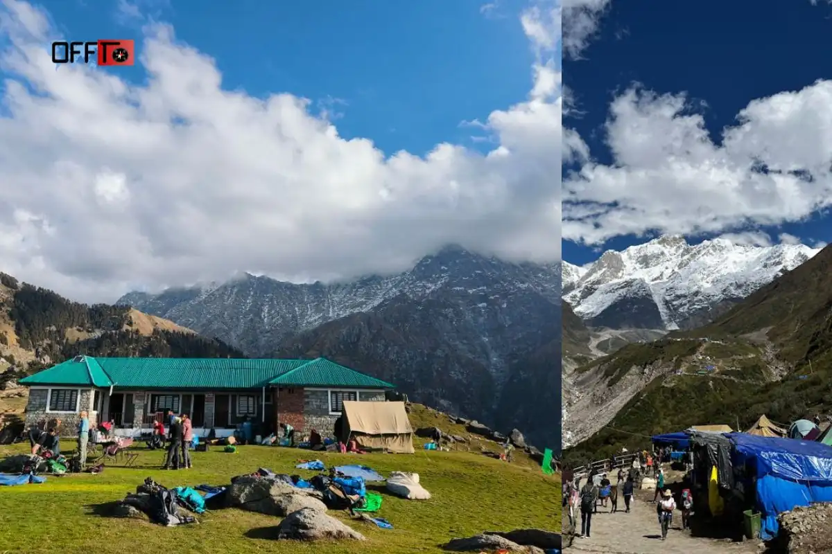
Day 7: Mantalai Lake to Summit Camp
This stage moves into higher-altitude terrain, with moraine and glacier-influenced sections becoming more relevant. The walking may feel slower because of altitude, rough ground and colder conditions.
Energy conservation is the main priority. Trekkers should reach Summit Camp with enough strength for the next day. Rest, hydration and early sleep matter more here than campsite exploration.
Day 8: Cross Pin Parvati Pass and Descend to Pin Base
The pass-crossing day is usually the hardest day of the itinerary. It often begins early and may involve steep ascent, snow or ice conditions, glacier-influenced terrain, high-altitude effort and a long descent after reaching Pin Parvati Pass.
Guide-led decisions matter throughout the day. Weather, group pace and trail condition can all affect movement. Reaching the pass is only part of the challenge; descending safely to Pin Base or the selected camp is the real completion of the day.
Day 9: Pin Base to Tiya
After the pass crossing, the route continues through the drier terrain of Pin Valley. The landscape changes sharply from the green Parvati side to the open, stark character of Spiti.
This stage may feel emotionally lighter after the pass, but fatigue can still be high. Trekkers should continue walking carefully and avoid treating the hardest part as fully over.
Day 10: Tiya to Mudh and Drive Towards Kaza
The final trekking stage usually leads towards Mudh, one of the key villages on the Pin Valley side. From here, many itineraries continue by road towards Kaza.
Road-transfer planning is important. After several demanding trekking days, even the drive can feel tiring. Confirm whether your package ends at Mudh, Kaza or another point.
Day 11: Kaza to Manali or the Selected Departure Point
Many itineraries include a long mountain-road journey from Kaza towards Manali or another departure point. This day should be treated as part of the expedition, not just a simple return transfer.
A buffer day is useful after the pin parvati pass trek because weather, road conditions and fatigue can affect the exit plan. Avoid scheduling tight flights or major commitments immediately after the trek.
How to Reach the Pin Parvati Trek Starting Point
Reaching Bhuntar or Manali
Most Pin Parvati Trek itineraries begin with travel towards the Kullu-Manali region. Bhuntar is an important access point because it connects road travel towards Kasol, Manikaran and Barshaini. Some operators may ask trekkers to report at Bhuntar, Kasol, Manali or directly near the Parvati Valley side, depending on the package design.
Manali is also commonly used as a gathering or transfer point, especially when the operator includes road movement to Barshaini. Before planning tickets, check the exact reporting location and time, not just the broad region mentioned in the itinerary.
Road Connection Towards Kasol and Barshaini
From Bhuntar or Manali, the route usually continues by road towards Kasol, Manikaran and Barshaini or a nearby village. Barshaini is commonly treated as the access point for the trekking trail on the Parvati Valley side.
This road journey should be planned carefully because mountain roads can take longer than expected. Weather, traffic, roadwork, landslides or local delays may affect travel time, especially during the trekking season.
Confirming the Actual Pickup Point
One of the most important pre-trek checks is confirming the actual pickup point. Some Pin Parvati Pass Trek packages mention Manali as the reporting base, while others may begin from Kasol, Bhuntar, Barshaini or Kalga. These differences affect arrival planning, hotel booking and total travel cost.
Do not assume that every operator follows the same access plan. Ask where the group meets, where the first night is spent, and whether the drive to the trailhead is included in the package.
Planning Around Mountain-Road Delays
Mountain-road delays are common enough that they should be planned for, not treated as surprises. A delayed bus, blocked road or slow transfer can affect rest, briefing time and first-day preparation.
For the pin parvati trek, arriving tired is not ideal. The route becomes progressively demanding, and poor sleep before the first trekking day can affect energy early in the itinerary. Keep extra time for arrival, especially if travelling from Delhi, Chandigarh or another distant city.
Why Arriving Early Is Sensible
Arriving early gives trekkers time to recover from road travel, check gear, meet the operator, understand the route plan and organize essentials before the trek begins. It also reduces stress if there are delays on the way to the starting point.
For a difficult crossover like Pin Parvati, the preparation day matters. Trekkers should use it to confirm rain protection, layering, footwear, medicines, snacks, water systems and documents. A calm start improves the chances of steady progress once the trail begins.
FAQs
What is the cost of the Pin Parvati Pass Trek?
The cost of the Pin Parvati Pass Trek usually varies by operator, duration, inclusions, group size and transfer plan. Current package examples often fall around ₹32,000–₹40,000, but prices can change. Always compare meals, camping gear, permits, guides, porters, transport and buffer-day policies before booking.
How difficult is Pin Parvati Trek?
The Pin Parvati Trek is difficult to very difficult. It includes long walking days, high altitude, river crossings, moraine, glacier-influenced terrain, snow or ice sections and limited exit points. It is best suited to experienced Himalayan trekkers with strong fitness and prior high-altitude trekking exposure.
How long is the Pin Parvati Pass Trek?
The Pin Parvati Pass Trek usually takes around 10 to 12 days, depending on the operator, route direction, road transfers and buffer days. Some itineraries count only trekking days, while others include arrival and exit travel. Always check the day-wise plan before comparing packages.
Where is Pin Parvati Pass located?
Pin Parvati Pass is located in Himachal Pradesh. It connects Parvati Valley in the Kullu region with Pin Valley in Spiti. This crossover is the main reason the trek feels dramatic, moving from greener forested terrain into colder, drier and more exposed high-altitude landscapes.
What is the Pin Parvati Trek distance?
The Pin Parvati Trek distance varies across itineraries because operators measure the route differently. Many packages describe the broader route around 100–110 km, while some may mention shorter trekking-only figures. Check whether the stated distance includes approach sections, exit trails or only core walking days.
What is the altitude of Pin Parvati Pass?
Pin Parvati Pass reaches roughly 17,450 feet, or about 5,300 metres. This altitude makes acclimatization essential. Trekkers may feel thinner air, slower recovery and high-altitude fatigue near the pass, especially during the crossing day when the ascent and descent are both demanding.
Is Pin Parvati Trek suitable for beginners?
No, Pin Parvati Trek is not suitable for beginners. The route is remote, long and physically demanding, with high-altitude sections, river crossings, rough terrain and limited exits. First-time trekkers should build experience on easier Himalayan treks before attempting this serious crossover expedition.
What is the best time for the Pin Parvati Pass Trek?
The best time for the Pin Parvati Pass Trek is generally July to September, depending on snow, rainfall, river flow and route accessibility. The safest period can shift each year, so trekkers should confirm current trail conditions and operator guidance before fixing departure dates.
Is a Pin Parvati Trek map available?
Yes, Pin Parvati Trek maps are available through trek operators and route guides, but a useful map should show more than a trail line. Look for major campsites, altitude progression, pass-crossing day, road transfers, Mudh, Kaza and an elevation profile for better planning.
Can Pin Parvati Pass be crossed in both directions?
Yes, Pin Parvati Pass can be crossed from Parvati Valley to Pin Valley or from the Spiti side towards Parvati Valley. Route direction affects altitude gain, acclimatization and itinerary flow. Before booking, ask which direction the operator follows and how high-camp movement is planned.
Does the trek end in Mudh or Kaza?
The main trekking section often ends around Mudh on the Pin Valley side, but many packages continue by road to Kaza. Some itineraries may also include onward travel towards Manali. Always confirm the actual endpoint because it affects transport, cost, buffer time and departure planning.
How is Pin Parvati Trek different from a regular Parvati Valley trek?
A regular Parvati Valley trek may involve shorter trails, easier access and lower commitment. The Pin Parvati Trek is a high-altitude crossover from Parvati Valley to Pin Valley, involving remote camps, glacier-influenced terrain, long trekking days and serious expedition-style preparation.
How can beginners trek in Parvati Valley?
Beginners can explore easier Parvati Valley trails such as short hikes around Kasol, Tosh, Kalga, Pulga or Kheerganga, depending on current access and fitness. These routes offer a gentler introduction to the region without the altitude, remoteness and difficulty of Pin Parvati Pass.
What previous trekking experience is needed for Pin Parvati?
Trekkers should ideally have completed at least one difficult multi-day Himalayan trek before attempting Pin Parvati. Prior high-altitude experience helps with pacing, acclimatization, fatigue management and confidence on rough terrain. Strong fitness alone is not enough for this remote crossover route.
Is Pin Parvati more difficult than Pin Bhaba Pass?
Pin Parvati is generally considered more difficult than Pin Bhaba Pass because it is longer, higher, more remote and involves tougher terrain near the pass. Pin Bhaba can still be challenging, but it is often treated as a more approachable crossover for prepared trekkers.
What should be included in a Pin Parvati Trek package?
A good Pin Parvati Trek package should clearly include guides, meals, camping equipment, permits, safety support, group gear, emergency planning and specified transfers. Check whether personal porters, transport to the starting point, return from Kaza or Manali, insurance and buffer days are included or extra.
Why do Pin Parvati itineraries show different distances and durations?
Pin Parvati itineraries show different distances and durations because operators count the route differently. Some include road transfers, arrival days, exit travel or buffer days, while others count only walking stages. Campsite choices and route direction can also change the total distance and duration.
Read more >>>
Dharamkot Himachal Travel Guide – Cafes, Trekking, Stay & Things to Do
Palampur Himachal Pradesh – Places to Visit, Weather & Things to Do
Plan Your Pin Parvati Trek with Offto Travellers
Planning the Pin Parvati trek requires more than choosing a departure date. With Offto Travellers, you can explore suitable trekking experiences, compare routes, check inclusions, understand operator guidance and choose an itinerary that matches your fitness and previous high-altitude experience.
You can also book stays before or after the trek, whether you need a relaxed pre-trek halt near Parvati Valley or a recovery stay around Mudh, Kaza or Manali after the crossover.
Start your Pin Parvati Pass Trek with better planning, safer choices and a smoother travel experience with Offto.
Sign up
Leave a Reply