
Bandaje Falls Trek is a scenic Western Ghats trail in Karnataka, known for its forest paths, Ballalarayana Durga Fort views, and a dramatic waterfall drop. The trek is moderate in difficulty, covering ~12–16 km round trip. Best visited post-monsoon, it offers a mix of adventure, viewpoints, and raw nature.
Bandaje Falls Trek in a Nutshell (Why It’s Worth It)
Bandaje Falls Trek is one of those trails in Karnataka that feels more raw than curated. It doesn’t rely on a single highlight—instead, the experience builds gradually. You start inside dense forest cover, transition into open grasslands, walk along a quiet ridge, pass the ruins of Ballalarayana Durga Fort, and eventually reach a waterfall that drops dramatically into a deep valley.
What makes this trek stand out is the sense of space. Even on weekends, it rarely feels crowded in the way popular Western Ghats treks do. There’s a natural rhythm to the trail—long walking stretches, shifting landscapes, and viewpoints that don’t feel staged.
It’s especially suited for those who enjoy slower, immersive treks rather than quick summit-style hikes. You’re not just reaching a destination—you’re moving through multiple terrains that each feel distinct.
For weekend travelers from Bangalore, it strikes a good balance: accessible enough to plan, but remote enough to feel like a proper escape.
Where is Bandaje Falls Located? (Route + Geography)
Bandaje Falls is located in the Western Ghats of Karnataka, near the border of Chikmagalur and Dakshina Kannada districts. The trek typically starts from Sunkasale village, which lies close to Kalasa and Kudremukh.
From Bangalore, the drive takes around 6–7 hours, making it a feasible weekend trip. Most travelers pass through Hassan → Belur → Kalasa → Sunkasale to reach the base.
Geographically, this region is part of the Kudremukh range, known for its dense forests, rolling hills, and high rainfall. The terrain shifts noticeably as you move through the trek—starting with shaded forest trails, opening into wide grasslands, and eventually leading to exposed ridgelines.
The waterfall itself flows down into a deep valley, and on clear days, you get expansive views of the surrounding hills stretching into the distance. It’s this mix of forest, ridge, and valley that gives Bandaje its distinct character among Karnataka treks.
Bandaje Falls Trek Details (Everything You Should Know Before You Go)
Before you plan the trek, it helps to have a clear idea of what the day will look like. Bandaje is not a short hike—it requires time, pacing, and some preparation.
The total trekking distance is usually around 12–16 km round trip, depending on the route you take and any detours near the fort or viewpoints. Most people complete it in 6 to 8 hours, including breaks.
The trek typically starts from Sunkasale, and it’s best to begin early—ideally by 7:00 AM or earlier. This gives you enough time to reach the waterfall, spend some time there, and return before it gets dark.
As of now, entry rules can vary depending on forest regulations. In some cases, a local guide or permission may be required, especially if you’re entering through forest zones. It’s always a good idea to check locally or go with someone familiar with the route.
There are no food stalls or facilities along the way, so you need to carry your own water, snacks, and essentials. Mobile network is patchy to non-existent for most of the trail.
In short, Bandaje Falls Trek is straightforward to plan—but it rewards those who come prepared and start early.
Bandaje Falls Trek Distance & Route Breakdown
The Bandaje Falls trek distance is typically around 12 to 16 km round trip, depending on how far you explore near the fort and waterfall viewpoints. While the number itself may not sound intense, the experience comes from the varied terrain and long walking stretches, not steep climbs.
The trail unfolds in distinct stages, each with its own character.
Forest Section (Start to Mid Trail)
The trek begins inside a dense forest stretch, especially if you’re starting from Sunkasale. This part is shaded, slightly humid, and feels quiet. The path is fairly defined but can be muddy during or after monsoon. It’s a gradual ascent, allowing your body to ease into the trek.
Open Grassland & Ridge Walk
After the forest, the landscape opens up into rolling grasslands. This is where the trek starts to feel expansive. The trail becomes more exposed, with long stretches of walking along ridgelines. On clear days, you get wide views of the Western Ghats, and the wind picks up noticeably.
This section is not technically difficult, but it can feel long—especially under direct sun.
Ballalarayana Durga Fort Stretch
Midway through the trek, you’ll pass the ruins of Ballalarayana Durga Fort. It sits on a ridge and acts as a natural viewpoint. Many trekkers take a short break here.
The terrain around the fort is relatively flat, making it a good point to reset before heading further.
Final Stretch to Bandaje Falls
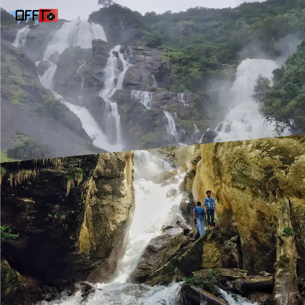
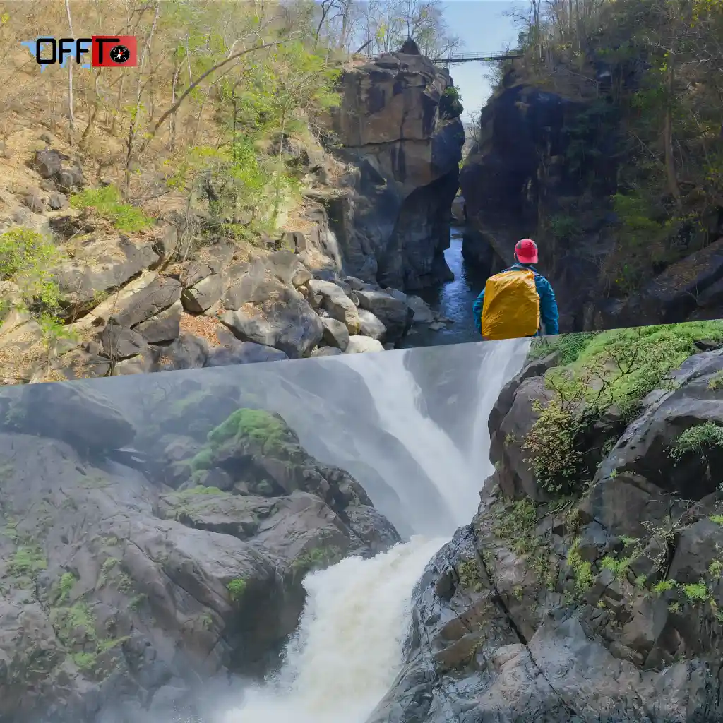
From the fort, the trail continues toward the waterfall. This part involves a mix of narrow paths and gentle descents, leading you to the edge where Bandaje Falls drops into the valley.
You don’t trek down to the base of the waterfall—instead, you reach a viewpoint at the top, which offers a dramatic perspective of the fall and the valley below.
Elevation & Terrain Overview
- Elevation Gain: Moderate (no extreme climbs, but consistent walking)
- Terrain Type: Forest trails → grasslands → ridge → rocky edges near the falls
- Difficulty Driver: Distance + exposure, not steepness
Overall, the trek is less about sharp ascents and more about endurance and pacing. The changing terrain keeps it engaging, but it also means you need to be prepared for both shaded and exposed sections.
Bandaje Trek Map & Route Navigation Tips
Navigation on the Bandaje Falls trek is relatively straightforward if you stay on the main trail—but it’s not something you should take lightly, especially if you’re trekking for the first time in this region.
How to Navigate the Trail
The most commonly used route starts from Sunkasale village and follows a well-trodden forest path that gradually opens into grasslands. From there, the trail naturally leads toward Ballalarayana Durga Fort, which acts as a key landmark. Once you reach the fort, the path toward the waterfall is easier to identify.
There are no official signboards throughout the trek, so navigation relies on:
- Following the visible trail
- Tracking footpaths used by other trekkers
- Using GPS support where needed
Offline Maps & Network Reality
Mobile network is extremely unreliable for most of the trek. You may get brief signals at higher points, but you shouldn’t depend on it.
It’s strongly recommended to:
- Download offline maps (Google Maps / Maps.me / AllTrails) before starting
- Save the route in advance
- Carry a power bank, as GPS usage drains battery
If you’re unsure about navigation, going with a local guide or someone who has done the trek before can make a big difference.
Common Route Mistakes to Avoid
- Taking alternate trails in the forest section: Multiple small paths branch out early on—stick to the most defined route
- Missing the fort junction: Some trekkers bypass Ballalarayana Durga Fort accidentally and lose the main trail flow
- Exploring too close to the waterfall edge: The terrain near Bandaje Falls can be deceptive and slippery
- Starting late: Poor timing can lead to navigating sections in low light during the return
Overall, the trail is not confusing if you stay attentive—but preparation matters. A little planning goes a long way in avoiding unnecessary detours.
How Difficult is Bandaje Falls Trek? (Honest Difficulty Guide)
Bandaje Falls Trek is best described as moderate, but not in a casual sense. It’s not technically challenging, yet it demands endurance, consistency, and some level of fitness.
Real Difficulty Level (No Generic Labels)
The trek doesn’t involve steep climbs or tricky sections for most of the route. What makes it feel challenging is:
- Distance (12–16 km round trip)
- Long continuous walking stretches
- Exposure to sun and wind in open sections
It’s the kind of trek where you don’t struggle in short bursts—but you feel it gradually over time.
Fitness Requirements
You don’t need advanced trekking experience, but you should be comfortable with:
- Walking 5–6 hours continuously with breaks
- Handling mild ascents and uneven terrain
- Carrying a daypack with essentials
Basic fitness—like regular walking, light cardio, or short hikes—is usually enough to prepare.
Who Should Attempt vs Avoid
Good fit for
- Beginners with decent stamina
- Weekend trekkers looking for a slightly longer trail
- Anyone comfortable with full-day outdoor activity
May find it challenging
- Absolute beginners with no walking endurance
- People expecting a short or easy hike
- Those not comfortable with long distances in open terrain
Is Bandaje Trek Difficult for Beginners?
For beginners, Bandaje can feel like a step-up trek rather than an easy introduction. It’s doable—but only if you pace yourself well, start early, and stay hydrated.
In simple terms, Bandaje Falls Trek is less about skill and more about how well you manage your energy across the day.
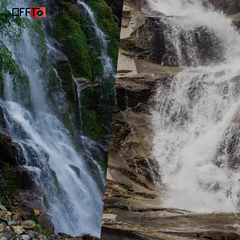
Is Bandaje Trek Safe in Rainy Season?
The Bandaje Falls trek during monsoon can be visually stunning, but safety depends heavily on timing, preparation, and ground conditions. It’s not a straightforward yes or no.
Ground Reality of Monsoon Trekking
During peak monsoon (June to early September), the entire region receives heavy rainfall. The forest becomes denser, streams swell up, and the waterfall is at its most powerful. However, the trail also becomes wet, slippery, and less predictable.
Post-monsoon (late September onwards) is usually a better balance—lush landscapes with improved trail conditions.
Risks to Be Aware Of
- Leeches: Common in forest sections during monsoon. Not dangerous, but uncomfortable
- Slippery terrain: Muddy trails and wet rocks increase the risk of slipping
- Low visibility: Fog and mist can reduce visibility, especially on ridge sections
- Trail confusion: Water flow can obscure parts of the path
- Strong winds near the falls: Edges can be risky if the ground is wet
When It’s Safe vs Unsafe
Relatively safer
- Light or intermittent rain
- Post-monsoon (late September to November)
- When trekking with proper footwear and preparation
Better to avoid
- Heavy continuous rainfall days
- Peak monsoon weekends with poor visibility
- If you’re inexperienced or trekking without navigation support
In short, the trek is doable in monsoon, but it requires caution. If you’re looking for a safer and more comfortable experience, post-monsoon is the ideal window.
What to Expect on the Trek (Experience Breakdown)
Bandaje Falls isn’t a one-moment trek—it’s a gradual shift in landscapes, where each section feels distinct from the last. The experience unfolds in layers rather than building toward just the waterfall.
Forest Trails & Canopy Walks
The trek begins inside a dense forest, where the trail is shaded and slightly humid. Tall trees block direct sunlight, and the path winds through roots, mud patches, and occasional clearings.
It’s quiet here—mostly the sound of wind and distant birds. This section feels immersive, almost like you’re easing into the trek rather than starting it.
Open Grassland Ridge Views
As you move forward, the forest opens up into rolling grasslands. The transition is noticeable—you suddenly have wide views, open skies, and a steady breeze.
This is where the trek starts to feel expansive. The ridge walk stretches out ahead, and on clear days, you can see layers of hills fading into the distance. It’s also the most exposed part of the trek, so the sun and wind are more noticeable here.
Ballalarayana Durga Fort Experience
Midway through the trail, you reach the ruins of Ballalarayana Durga Fort. It’s not a large structure, but its location makes it special.
Sitting on a ridge, it offers a natural pause point. Most trekkers stop here to rest, take in the views, and reset before continuing. The fort adds a subtle historical layer to the trek, breaking the rhythm of just walking.
Final Waterfall Viewpoint
The last stretch leads you toward Bandaje Falls, but instead of reaching the base, you arrive at a viewpoint at the top of the drop.
This is where the scale of the landscape becomes clear. The waterfall plunges into a deep valley, and the surrounding cliffs and hills create a sense of openness that’s hard to capture in photos.
There’s no crowding or built viewpoint—just a raw edge, where you sit, pause, and take it in.
Ballalarayana Durga Fort — The Highlight of the Trek
Somewhere in the middle of the Bandaje trek, the trail leads you to the ruins of Ballalarayana Durga Fort—a quiet structure that adds a different dimension to the journey.
Historical Significance
The fort is believed to date back to the Hoysala period, though very little of the original structure remains today. What stands now are scattered stone walls and remnants that hint at its past.
It doesn’t feel like a typical tourist monument. There are no signs, no restoration work—just ruins that blend into the landscape. That’s part of what makes it feel authentic.
Panoramic Views
What truly makes the fort memorable is its location on a ridge. From here, you get wide, uninterrupted views of the surrounding Western Ghats.
On clear days, the hills stretch endlessly in layers, and the wind moves steadily across the open space. It’s one of those points where most trekkers instinctively slow down—less for photos, more to just take it in.
Why It Elevates the Trek Experience
Without the fort, the trek would still be scenic—but the fort adds a natural midpoint and a shift in experience.
It breaks the journey in a meaningful way:
- A place to pause and reset
- A transition from forest and grassland to open ridge
- A moment that feels slightly removed from the physical effort of trekking
It’s not the main destination—but it’s often what people remember just as much as the waterfall.
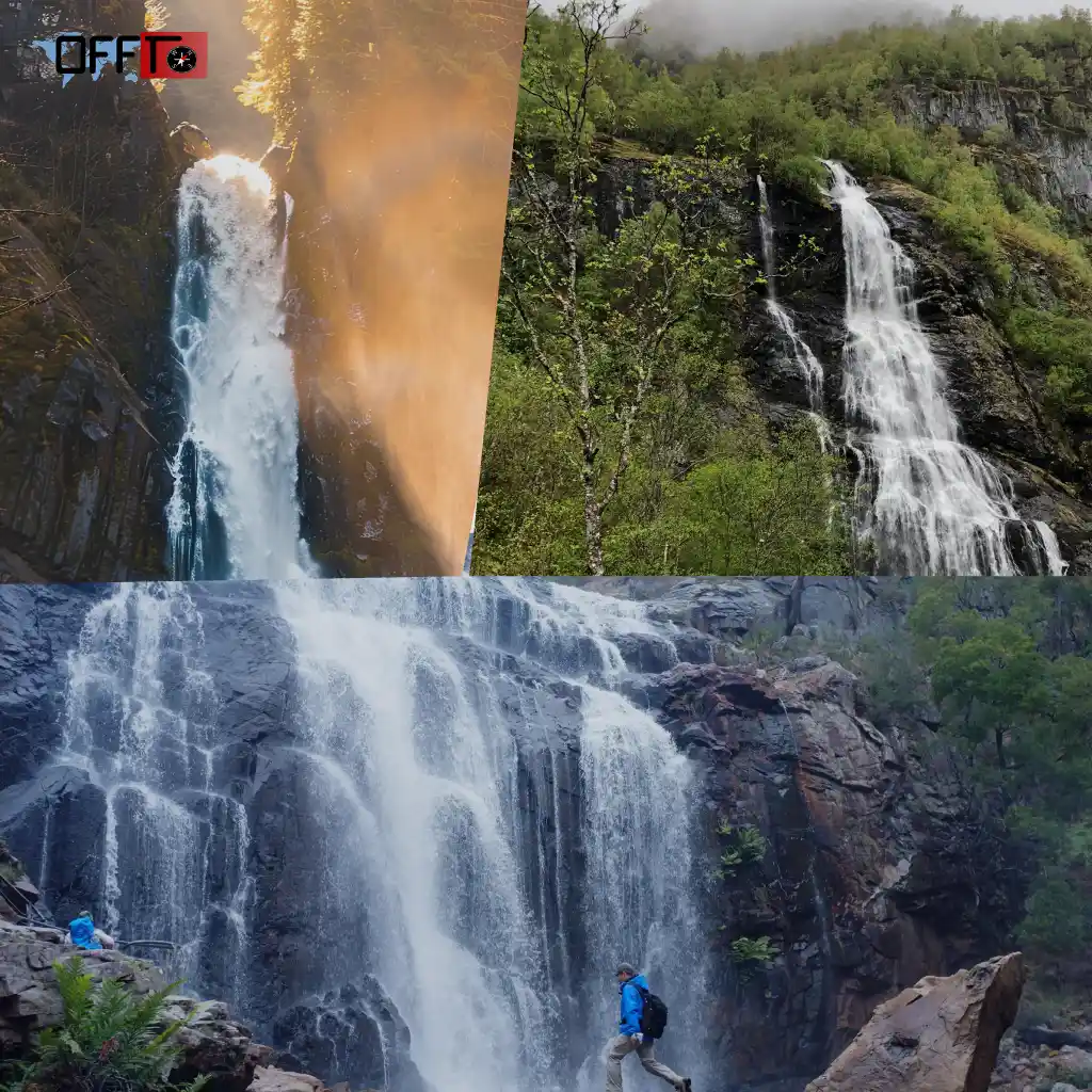
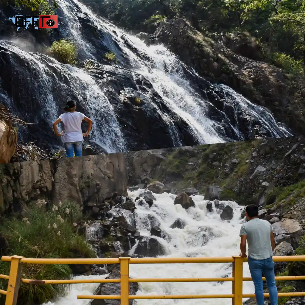
Bandaje Falls — What Makes It Special
Bandaje Falls is not a waterfall you walk up to casually. You don’t stand at its base or wade into a pool. Instead, you experience it from above—and that’s what makes it different.
Height & Visual Appeal
From the top, you don’t just see the water—you see the entire landscape it cuts through. The contrast between the open ridge and the sudden drop creates a dramatic visual moment.
It’s less about proximity and more about scale.
Best Viewpoints
The main viewpoint is at the edge near the top of the falls, where the trail naturally leads. There aren’t designated platforms or railings—just open ground.
If you explore slightly along the ridge (carefully), you can find angles that offer:
- A clearer view of the waterfall drop
- Wider valley perspectives
- Better photo compositions without obstruction
Safety Near the Waterfall Edgece
This is one area where caution matters.
- The ground near the edge can be uneven and slippery, especially after rain
- There are no barriers or protective fencing
- Strong winds can make balance tricky at exposed points
It’s best to:
- Keep a safe distance from the edge
- Avoid unnecessary risks for photos
- Stay aware of footing at all times
Bandaje Falls doesn’t overwhelm with accessibility—it stays slightly out of reach. And that’s what makes the experience feel more raw and memorable.
Suggested Itinerary for Bandaje Falls Trek
Planning the trek well makes a big difference, especially since it involves travel, an early start, and a full day of walking. Here are two practical itineraries based on how relaxed you want the experience to be.
2-Day Itinerary (Relaxed Weekend Plan)
This is the most common plan for travelers coming from Bangalore or nearby cities. It keeps things efficient without feeling rushed.
Day 1: Travel + Base Stay
- Start from Bangalore early morning or by afternoon
- Drive via Hassan → Belur → Kalasa → Sunkasale
- Reach by evening and check into a homestay near the base
- Keep the evening light—rest, eat early, and prepare for the trek
- Sleep early to ensure a smooth start the next day
Day 2: Early Trek + Return
- Start the trek by 6:30–7:00 AM
- Reach Ballalarayana Durga Fort by mid-morning
- Continue to Bandaje Falls viewpoint and spend some time there
- Begin descent by early afternoon
- Complete the trek by late afternoon (around 3–4 PM)
- Freshen up (if possible) and start return journey
3-Day Itinerary (Slow Travel Experience)
If you prefer a more relaxed pace, this version spreads things out and adds a bit more depth to the trip.
Day 1: Travel + Settle In
- Start from your city and reach the base region by afternoon
- Check into a homestay in Sunkasale / Kalasa
- Take a short walk around the area or simply unwind
- Early dinner and rest
Day 2: Trek + Stay
- Begin the trek early, similar to the 2-day plan
- Take your time through each section—forest, ridge, fort, waterfall
- Spend longer at the fort or viewpoints without feeling rushed
- Return by late afternoon
- Stay another night near the base and recover
Day 3: Nearby Exploration + Return
- Visit nearby spots like Kalasa town or Kudremukh viewpoints
- Have a relaxed breakfast and start your return journey
- Reach back by evening
This itinerary is ideal for:
- Couples who prefer slower travel
- Small groups wanting a more relaxed experience
- Anyone who doesn’t want to combine trekking and long travel on the same day
Where to Stay Near Bandaje Falls
There are no hotels or commercial stays right at the trek point, so most travelers base themselves in nearby villages like Sunkasale, Kalasa, or Horanadu. The experience here is simple, local, and closely connected to nature.
Homestays in Sunkasale / Kalasa
The most common option is staying at a local homestay. These are usually family-run places that offer:
- Basic, clean rooms
- Home-cooked meals (often included)
- Early breakfast support for trekkers
Sunkasale is closest to the trek start point, while Kalasa has slightly more options and better accessibility.
Staying in a homestay also makes logistics easier—many hosts help with directions, local guidance, and timing tips for the trek.
Budget vs Comfortable Options
- Budget stays:
Simple rooms, shared or basic facilities, ideal if you’re just looking for a place to rest before and after the trek
- Comfortable homestays:
Slightly better rooms, attached bathrooms, more structured meals, and a more relaxed environment
There aren’t luxury resorts in the immediate area, which actually helps preserve the raw, non-commercial feel of the region.
Staying Closer to Nature
One of the best parts of this trek is how close you stay to the landscape. Even basic homestays are surrounded by greenery, hills, and quiet roads.
Evenings are usually calm—no nightlife, no crowds—just the sound of insects, distant wind, and occasional conversations. It naturally sets the tone for an early start the next day.
Essential Travel Tips for Bandaje Falls Trek
A little preparation goes a long way on this trek. Since there are no facilities along the route, what you carry and how you plan your day matters.
What to Pack
Keep it light, but practical:
- Comfortable trekking shoes with good grip
- Backpack with essentials
- At least 2–3 liters of water per person
- Energy snacks (fruits, dry snacks, ORS)
- Cap, sunglasses, and sunscreen
- Light rain jacket (especially post-monsoon)
- Basic first aid kit
If you’re trekking in monsoon, carrying leech protection (salt or spray) can help.
Start Early Strategy
Starting early is one of the most important decisions you’ll make.
- Begin the trek by 6:30–7:00 AM
- Helps avoid harsh sun during ridge sections
- Gives you buffer time for breaks and delays
- Ensures you return before evening
Late starts often turn the return journey into a rushed experience.
Water & Food Planning
There are no shops, stalls, or water sources you can rely on during the trek.
- Carry all your water from the base
- Pack enough food for the entire day
- Avoid depending on streams (not always safe or accessible)
It’s better to carry slightly extra than run short midway.
Network & Safety Considerations
- Mobile network is weak to non-existent for most of the trail
- Inform someone about your plan before starting
- Trek with a group if possible, especially if it’s your first time
- Be cautious near edges and exposed viewpoints
If you’re unsure about navigation, consider going with someone familiar with the route or a local guide.
A Quick Personal Note: What Bandaje Falls Really Feels Like
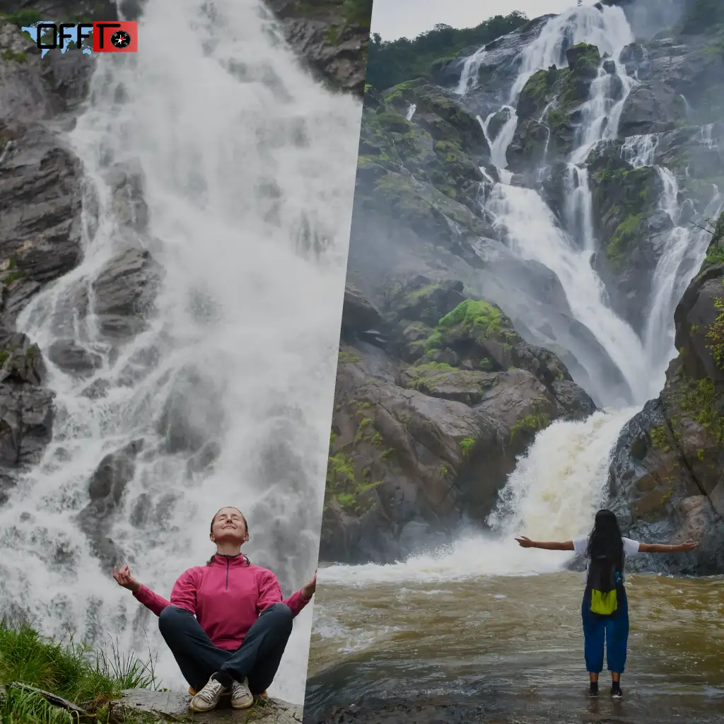
Bandaje Falls doesn’t feel dramatic in the usual sense. There’s no sudden reveal or crowded viewpoint where everyone gathers. Instead, it unfolds quietly.
For most of the trek, you’re just walking—through forest, across open grassland, along a ridge where the wind stays constant. Conversations fade in and out, and at some point, you start noticing the silence more than anything else.
By the time you reach the edge near the waterfall, it doesn’t feel like you’ve arrived at a “spot.” It feels like you’ve moved through a landscape that slowly opened up.
The waterfall itself is powerful, but what stays with you is the space around it—the valley, the wind, the distance. There’s nothing constructed here, nothing trying to hold your attention. You just sit for a while, without really needing to do anything.
And on the way back, the trail feels familiar—but quieter.
FAQs
How long is Bandaje Falls trek?
The Bandaje Falls trek is around 12 to 16 km round trip, depending on your route and exploration near the fort or waterfall. Most trekkers take 6 to 8 hours to complete it comfortably, including breaks. It’s a full-day trek, so starting early is important to avoid returning late in the evening.
Is Bandaje Falls trek difficult?
Bandaje Falls trek is considered moderate in difficulty. It doesn’t involve steep climbs, but the long distance and continuous walking can feel tiring. Beginners can attempt it if they have decent stamina, but it’s not an easy hike. The challenge comes more from endurance than technical difficulty.
Is Bandaje trek safe during monsoon?
Bandaje trek can be done during monsoon, but it comes with risks like slippery trails, leeches, and low visibility. Heavy rain can make navigation harder and increase chances of slipping near exposed areas. It’s safer to visit in post-monsoon (September–November) when the landscape is lush but trails are more stable.
What is the best time to visit Bandaje Falls?
The best time to visit Bandaje Falls is between October and February. Post-monsoon months offer green landscapes and a strong waterfall flow, while winter provides clear skies and comfortable trekking conditions. Avoid peak summer afternoons, as the exposed ridge sections can get quite hot and tiring.
Do I need a guide for Bandaje trek?
A guide is not mandatory if you are familiar with trekking and navigation, but it can be helpful for first-timers. The trail is mostly visible, but there are multiple paths in forest sections. If you’re unsure or trekking in a small group, having a local guide reduces the chances of taking wrong routes.
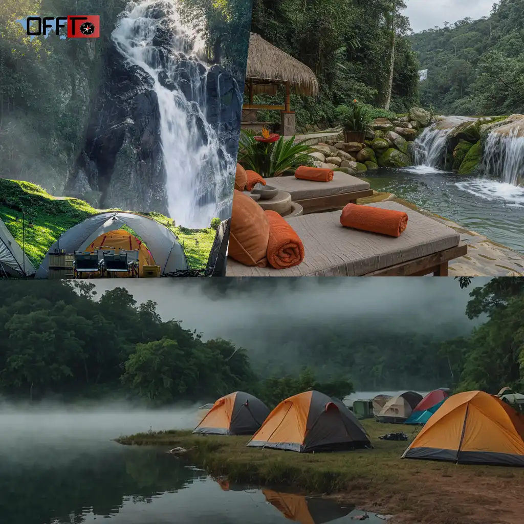
Is camping allowed near Bandaje Falls?
Camping near Bandaje Falls is generally not officially permitted, especially close to forest zones and the waterfall edge. Some trekkers camp near Ballalarayana Durga Fort, but rules can vary. It’s best to check local regulations or stay at nearby homestays to avoid safety or permission issues.
Where does the Bandaje Falls trek start?
The Bandaje Falls trek usually starts from Sunkasale village, located near Kalasa in Karnataka. This is the most common and accessible route. From here, the trail passes through forest, grasslands, and the Ballalarayana Durga Fort before reaching the waterfall viewpoint.
Can beginners do Bandaje Falls trek?
Yes, beginners can do Bandaje Falls trek if they have basic fitness and stamina. It’s not technically difficult, but the long distance requires endurance. Beginners should start early, carry enough water, and maintain a steady pace. It’s better to avoid attempting it without preparation or during heavy monsoon.
Is there water available during the trek?
There are no reliable water sources along the Bandaje trek route. Trekkers should carry at least 2–3 liters of water per person for the entire day. Depending on streams is not recommended, especially in dry or unpredictable conditions. Planning your hydration in advance is essential.
How to reach Bandaje Falls trek from Bangalore?
Bandaje Falls trek is about 300 km from Bangalore, and it takes around 6–7 hours by road. The usual route is via Hassan → Belur → Kalasa → Sunkasale. Most travelers prefer driving or taking a bus to Kalasa and then hiring local transport to reach the trek starting point.
Read more >>>
Chandrashila Trek – Complete Guide to Route, Distance & Best Time
Brahmatal Trek – Complete Guide to Distance, Route & Best Time
Plan Your Bandaje Falls Trek with Offto Travellers
Planning a trek like Bandaje becomes easier when you’re not just relying on scattered information. That’s where Offto Travellers fits in.
It’s designed for people who want to explore, plan, and experience travel more intentionally—whether it’s a weekend trek or a longer escape.
You can:
- Discover real travel stories and experiences from places like Bandaje Falls
- Save trips and build your own itineraries without overcomplicating things
- Find and book homestays, activities, and weekend getaways in one place
- Connect with a growing community of travelers exploring offbeat destinations
Instead of jumping between multiple platforms, Offto brings everything together—so you spend less time planning and more time actually traveling.
Play StoreApp Store
Leave a Reply